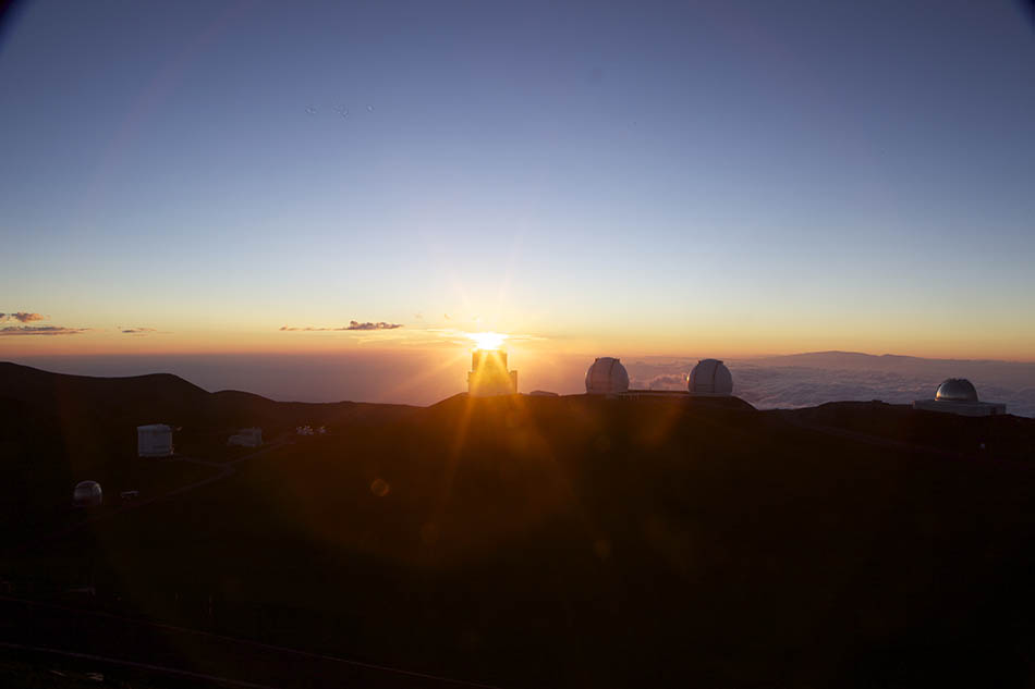
Morocco, Casablance and the Sahara

Morocco, Casablance and the Sahara

Duration: 10 days, 9 nights
Location: Morocco, Africa
Budget: $1750
Miles Travelled: 1970KM

Days: 10
Dates: 22nd March 2018 to 31 March 2018
Tour Company: Morocco Round Trips
Currency: Dirham (10.7:1 exchange rate)
Time Zone Difference : None
Morocco Driving Distance : 1970KM approx


Day 1 – SHANNON – STANSTED

We took an evening flight from Shannon to Stansted with Ryanair. Departure time was 21:15 and we arrived around 22:40 and collected our bags. We got a 3 pound shuttle to the airport hotel, checked in and got to bed around midnight. The shuttle took approximately 5 minutes to get the to hotel and left every 30 minutes .

Day 2 – STANSTED – MARRAKESH

Up at 03:00 to get the 04:00 shuttle back to the airport. This was the first shuttle of the morning. We checked in our bags and proceeded to the gate. No problems with bags or luggage thankfully. Flight time was three hours 30 minutes to Marrakesh. We arrived around 09:45 and went through passport control and got our luggage. Customs checked our bags for drones etc so be sure not to bring any. There is a nice little app called Airmap that you can download for iOS and Android that will tell you the rules and regulation of a country you are planning to visit and if it is allowed to bring a drone with you. We got outside and waited for our collection. The tour operators cannot go inside the airport so you need to exit in order to get collected by your company. Our company was late so we called them and eventually got collected and driven to the Riad in the old town or Medina. We checked in to the Riad Anika around noon and left our bags there. We put the batteries on charge and headed out for a tour of the city with a local guide at 14:00 hours.

Everyone talks about TIA – This is Africa – re timing etc so be prepared to wait around for drivers or guides or tours to run on time according to their website. The weather was nice and warm today so we met our guide at 14:00 and started a tour of the old city – the Medina – in Marrakesh – which is known as the “Red City”. Marrakesh is a former imperial city in western Morocco, a major economic center and home to mosques, palaces and gardens. The medina is a densely packed, walled medieval city dating to the Berber Empire, with mazelike alleys where thriving souks (marketplaces) sell traditional textiles, pottery and jewelry. We visited several main attractions in our afternoon including :

    • The Koutoubia Mosque, which is an old monument built under the reign of the Almohad Caliph Yaqub al-Mansur (1184 to 1199). A symbol of the city, and visible for miles, is this Moorish minaret of the 12th-century. This monument inspired other buildings such as the Giralda in Seville in Spain and the Hassan Tower in Rabat.
    • The Bahia Palace was next on our list. This Palace was built in the late 19th century and was intended to capture the essence of the Islamic and Moroccan style.
    • Madrasa Ben Youssef. This Coranic school is named after the Almoravid Sultan Ali Ibn Yusuf (reigned 1106–1142). Madrasa Ben Youssef is the largest in all of Morocco.
    • The Saadian tombs, which is a site that dates back to the time of the sultan Ahmad al-Mansur (1578-1603). The tombs were discovered in 1917 and were restored by the Beaux-arts service :
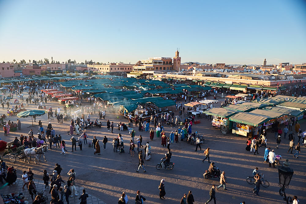
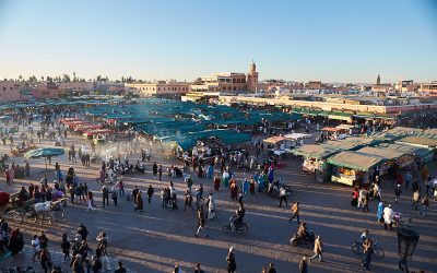
    • The world famous Jema El Fna Square where we enjoyed amazing performance of traditional activities by storytellers, snake charmers, peddlers of traditional medicines and the markets. Beware the hawkers and snake charmers – they will give you the snakes to take pictures with and then ask for 200 DH (approx 20 euro) or if they see you taking pictures of other people with the snakes they will harass you for money because you took a picture or video.

After this, we got some dinner, had a drink in the glacier bar overlooking the Jema El Fna square as the sun set and then made our way back to the Riad – approximately 15 minutes walk or 1 mile away.
Day 3: MARRAKECH – CASABLANCA – RABAT (330KM)

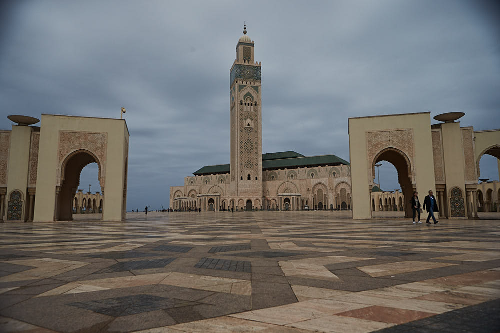
After a good nights sleep we got collected around 08:00 and started out on the three hour driver to Casablanca (245KM due North). The roads were good and the weather was nice. One thing that we noticed and were a little surprised by was that everything was so green outside. We stopped for a coffee half way and the lads had a nice crepe and Nutella to keep the hunger at bay. Arrived in Casablanca around 11:15 We visited the famous and the biggest Mosque in Africa, Hassan II, which was built between 1987 and 1993. It is very impressive and vast. We spent an hour here walking around and taking pictures. The last tour at the museum started at 11:00 so we missed this. The tour of the Mosque was not until the afternoon. Check the times before you arrive if you are interested in partaking in either. We then headed to Ricks Cafe – from the movie Casablanca – and got some lunch before driving to Rabat, the capital of Morocco. It took just over an hour to get to Rabat and meet our local guide, Mohamed.

We visited the Royal Gates built in 1864, and enjoy the charming garden of Chellah, surrounded by walls and beautiful defensive gates, built between 1310 and 1330. Later we stopped at Mohamed V Museum built in 1972, and then visited the tombs of Moroccan kings Mohammed V, who died in 1962, Hassan II who died in 1999, the tomb of Moulay Abdullah the uncle of Mohammed VI and Hassan Tower which was built in 12th century. We explored the Oudaya Kasbah which was built in 12th century and served as a military base for the Almorabits army in their defence against the Spanish army. The roof of the Kasbah allows a stunning view of the surrounding area. We also saw the 240km long Abi-Regrag river, located in western Morocco between Rabat and Sala. Overnight in Rabat at the Riad Dar Dar. We had to walk down a few streets and back track a little before we found the Riad – nestled away down some narrow alley and walkway. It was nice inside and we were greeted with the standard Moroccan Tea welcome before checking in.

We got dinner in the Riad and walked around the city’s market streets and bought some trinkets before retiring for the night.

Accommodation : Rabat :www.riaddardar.com
Day 4: RABAT – CHEFCHAOUEN (300KM)

After breakfast we will drive to Chefchaouen, the blue city, through the cities of Khnetra, stopping in Ouazzane, passing by spectacular scenery with cedar, oak and almond trees. We arrived in Chefchaouen around lunch. The day was wet and damp all the way to Chefchaouen. The road had a lot of switch backs, twists and turns and narrow sections and there was a lot of climbing and descending. It is worth taking your time and stopping often to get some air and not get sick. The travel time was around 5 hours from Rabat – including stops.

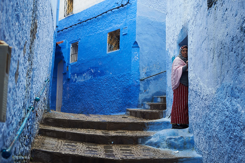
In the afternoon, we looked around the Blue City. We had lunch in the Aladdin Restaurant in one of the main squares before exploring some more. The rain cleared off but the clouds remained and the temperature was lower than Rabat so we had a jumper and jacket on us for the walk around. Set against a wide valley and nestled between two peaks in the stunning Rif Mountains, the isolated town of Chefchaouen is a surprising delight. Much of Chefchaouen was recreated by Andalusian refugees escaping the Reconquistia, so its striking blue and whitewashed houses, red-tiled roofs and artistic doorways give it the feel of the Spanish hills. We spent the rest of the afternoon exploring the sights, sounds, and smells of the medina, the shops in the square selling woven goods and small sweets, and the town’s famous goat’s cheese. Herds of goats wander the sparse hillsides that surround Chefchaouen, and their cheese is sold in great fresh rounds in the street markets. Within the plaza is the walled fortress of the Kasbah – where you can wander through the tranquil gardens inside, visit the ethnographic museum, and soak in wonderful views from the rooftop. Around 18:00 we visited the Ras el-ma, where the city’s fresh water springs from the mountain. There is a path up the mountain here to give you a panoramic view of the city.

We returned to our accommodation for the night, got some dinner and watched a movie before preparing for the drive South towards the desert the following day.
Day 5: CHEFCHAOUEN – VOLUBILIS – FES (250KM)

We got up around 06:30 and did an early morning sunrise walk around the Blue City and saw it come to life. After breakfast we descended from the hills and traveled south through the centre of the peninsula towards the sacred pilgrimage town of Moulay Idriss (approximately 3 hours). From here it’s a short journey out to the World Heritage site of Volubilis – meaning Morning Glory. The remains of this Roman city make an undeniably impressive sight as they came into view on the edge of a long, high plateau. We took a 45 minute tour around the arches, basilicas, and superb mosaics along the Decumanus Maximus, many of which remain intact. We then drove onto Fes, arriving there around 14:30. Fes is the spiritual heart of Morocco.

We collected our guide at the Blue gate and started our tour immediately. We started in the Medina – one of the world’s largest walled-in cities.  In the south west wall of the medieval Medina is a beautiful looking entry, the Bab Bou Jeloud. It gives excess to narrow streets that are lined up with little stores that sell fresh fruits, spices, woven Berber carpets etc.  This medina is very large, approximately 3 km and therefore one of the largest medina´s of the world.   We visited the El Qaraouiyyin Mosque, a traditional school, the place Nejjarine and the tanneries. At the tanneries you can watch locals work on skins of goat, lamp, camel and cow, in small clay pits. Sheep is cheap is the famous saying from the tanneries re the hides etc. We saw the Royal gates and had a nice panoramic view of the city before checking into our Riad. There was a problem with the sleeping situation in the Riad and the owner was not very accommodation. We had booked a twin bed and they only had a double available – according to them. Then dinner in Cafe Clock near the Blue gate and walked back to the Riad and slept.
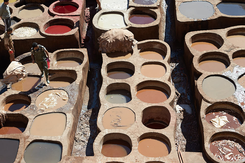
Day 6: FES – MIDELT – ZIZ VALLEY – MERZOUGA (420 KM)

Today was a long day with a lot to see and do. After breakfast in the Riad, we drove south to Ifrane and Azrou through the Middle Atlas Mountains. The air was crisp, clean and fresh. You can feel the altitude when stepping out of the van. The Berber name of Ifrane means caves and it is nicknamed in Morocco as a little Switzerland since it is a very green town and is a ski resort in the Middle Atlas region of Morocco because of its high altitude at 1665 meters. Ifrane is famously known for the Brotherhood Private University, established in 1997 by The King of Morocco Hassan II and the King of Saudi Arabia Fahd – where all classes are taught in English. It is an international university. After Ifrane, we stopped at the cedar forest where we saw the Barbarian Apes in their natural habitat. Then we drove through the Tizi Ntalghamt pass to Midelt. Midelt is in the Middle Atlas and is called “the apple capital”. We got lunch here before traveling along the magnificent Ziz Valley oasis carved through volcanic rock. The Middle- Atlas offers some beautiful views. . Upon approaching Errachidia we saw the scenery change to a dessert environment. Onward we traveled through Erfoud, Rissani and we ended our drive in Merzouga . We arrived here around 17:30 that day.

In Merzouga, we mounted our camels and headed off into the Sahara for a spectacular sunset at the Erg Chebbi Sand dunes.  Merzouga is the hometown of the Alaouist dynasty, where Moulay Ali sheriff started to unify Morocco under his red flag in the beginning of the 17th century. The camels brought us to a camp in  the middle of the Erg Chebbi Sand Dunes. These are the highest sand dunes in North Africa. The camel trek to the camp takes about 60-90 minutes depending on your schedule. Some tour companies get you to camp within 60 minutes and let you climb the closest dunes to see the sun set whereas others will stop en-route and allow you to dismount and enjoy the sunset away from camp.  Here, in the middle of the desert we experienced a magnificent sunset and afterwards the sky came alive with stars. .We spent the night in the camp with dinner and live music in the middle of the Sahara.
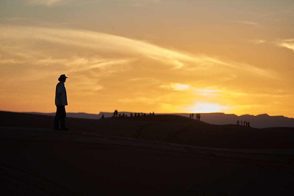
Day 7: MERZOUGA – RISSANI – ERFOUD – TODGHA GORGES – DADES (280 KM )

We got up for sunrise in the Dunes followed by breakfast and some sand boarding. Then we drove some quad bikes for an hour to get back to town before heading towards Dades. We left Merzouga and headed for Rissini – approximately 30 minutes drive. This silent town was once the ancient capital of Tafilalet and its location is at a crossroads between north and south Morocco. It brought the city to an important status of a former major caravan center. Up to now Rissani remains a major commercial center in the region, with a large souk, particularly lively on Tuesdays, Thursdays and Sunday. It was noted for its leather and goat skin trading in ancient ages. The souk is busy on the other days also and worth a walk around to experience the environment and setting.

After this we traveled to Erfoud. Fossils are a major industry in Erfoud – some 350 million years ago the region around Erfoud was a part of the huge ocean. We got a tour of the facilities and saw how they mine and shape the fossils once they are excavated. On the way to the Todgha Gorges we passed the palm trees groves approx 127 km from Rissini. The great canyons of Morocco  – the Todgha Gorges – are situated beyond the central high Atlas Mountains. Here, the contrasting landscapes remind visitors of the Colorado, with its high plateau, its gorges and great canyons, and its peaks sometimes splintered by erosion. Several peaks in this area exceed 4000 m, with Jbel Saghro 2500 m and Jbel Mgoun at 4068 m being the highest peak in this part of the High Atlas. If you look up, you might see climbers scaling the different peaks. The area is populated by Berbers. In the Todgha Gorge we walked through the area and took some pictures before getting back on the road to the next stop. Finally we drove to the Boumalne Dades where we spent the night. Dinner was included this evening – a buffet affair – followed by a walk around the grounds before retiring for the night.


Day 8: DADES VALLEY – OUARZAZATE – AIT BEN HADDOU – MARRAKECH ( 350 KM )

We got up and had breakfast and were back on the road for 09:00. We drove along the road of 1000 kasbahs, since there are enormous Kasbahs on both sides of the road. Some of those old fortified houses are restored but unfortunately a lot of them are in ruins. We drove first to the Dades gorge & valley. Here you saw the rock formations “human bodies, fingers of monkeys “. After a stroll through the impressive Dades Gorge, we’ll drove on to Ouarzazate passing by the valley of the Roses. This valley provides some of the most spectacular scenery of the south, this is where a large part of Morocco’s rose and rose water production occurs. We stopped for a coffee and bought some curios in the local shops. This valley gave birth to a rose from which locals produce different cosmetic products like soap, perfumes and skin creams. Locals here celebrate this rose by organizing a national festival at the end of April every year. We continued along the road of thousand Kasbah to the oasis of Skoura to visit the Kasbah of Amredil. Our trip continued to the city of Ouarzazate, a city of vibrant culture and artistic traditions.

We stopped here for some lunch. First we visited the museum with cinema props and sets from the Hollywood movies. Entry cost for the visit was 30 DH per person. Ouarzazate (Hollywood of Africa, Noiselessly town, The door of the desert), is a city situated in the middle of a bare plateau, south of the High Atlas Mountains. It is mainly inhabited by Berbers, who constructed many of the prominent kasbahs and building for which the area is known.


After lunch we visited the fortified city of Aït Benhaddou, built in the 11th century. Once up on a time this Kasbah was the former caravan route between the Sahara and Marrakesh. It is situated on a hill along the Ounila River and has some beautiful examples of kasbahs, which unfortunately sustained damage during each rainstorm and windstorms. Most of the town’s inhabitants now live in a more modern village at the other side of the river; however, around five families are still living within this Kasbah.

Aït Benhaddou Kasbah has been a UNESCO World Heritage Site since 1987 and several films have been shot there, including Lawrence of Arabia (1962), Time Bandits (1981), The Jewel of the Nile (1985), Kundun (1997), Gladiator (2000) and Alexander (2004). From this beautiful fortified house we went west to the city of Marrakech. It is called the “Homeland of God in Berber”. The ramparts of the town are nearly 30 kilometers long. Then we drove through the Atlas Mountains and saw amazing views. The roads were windy and rough in places so the going was slow and easy for the most part. After driving back over the winding Tizi-n-Tichka pass we arrived back to Marrakech around 21:00. We were staying in the same accommodation as the first night.
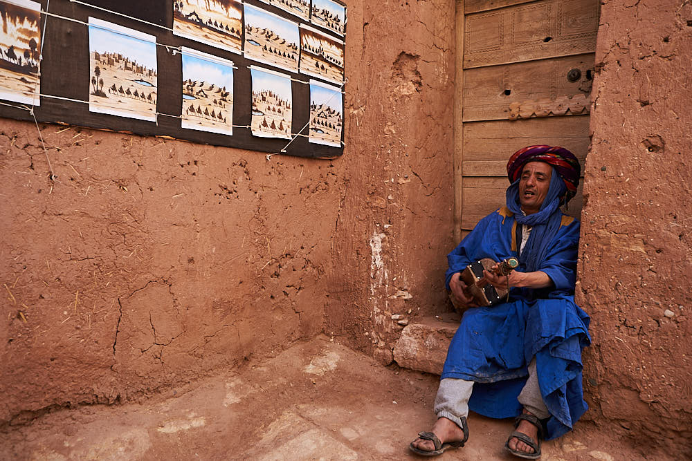
 

Day 9: MARRAKECH – ESSAOUIRA- MARRAKECH (400 KM)

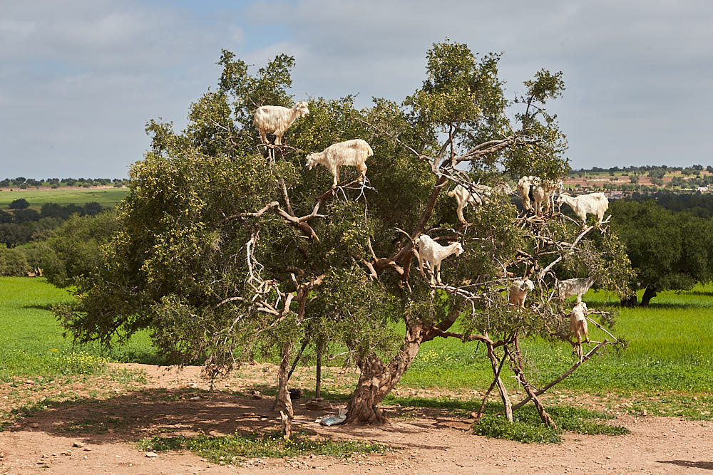
We contacted a tour company earlier in the week and booked a day trip to Essaouira for our last day. The company was late in starting, late getting to the destination and thankfully left on time to get us back home. We drove for nearly four hours with all the stops and getting out of the city. We arrived in Essaouira at 13:00 after stopping for a coffee, a photo of the famous goats in the Argan trees and the shop showing the Argan nuts being ground and made into oils and creams. We went surfing for an hour first – you definitely need a wetsuit if you are going in to the water – and then got some lunch and looked around the Medina before coming back to the bus and departing at 16:00. The area is nice and there are a lot of wind and kite surfers visiting and staying locally. We stopped for coffee on the way back around 17:15 and arrived back in Marrakech around 19:00. We got dropped off in the Jema El Fna square and walked a very similar route to the first days tour before heading back to the Riad for dinner and repacking.


Day 10 MARRAKECH – STANSTED – SHANNON

We got an email from Ryanair re coming to the airport an hour earlier in order to get through security so we left the Riad at 07:30 and arrived at the airport for 08:00. The first queue was to get into the departure section . All bags were scanned and we had to show a boarding pass. Then we proceeded to queue at the desks and drop the bags before heading to the Security check for the next queue. Once through here we went through the biggest queue for passport control and then into the Gate area where we got a coffee and chatted before heading to our gate for the final queue to head home. All in all we needed to be at the airport 3 hours before the flight due to the queues and security checks.

The flight was delayed leaving Marrakesh but we got into Stansted around 15:30 and got our bags by 16:00. We said good luck to Garry and then headed through the bag drop section and security again. We got into the departure section around 18:00, got some food and headed to the gate before getting the flight home to Shannon at 19:55. It was wet and cold in Stansted and Shannon.
Recent Travels

Be sure to check out our recent reports from the other trips that we have done around the world.

Morocco, Casablance and the Sahara

Morocco, Casablance and the Sahara

Duration: 10 days, 9 nights Location: Morocco, Africa Budget: $1750 Miles Travelled: 1970KMDays: 10Dates: 22nd March 2018 to 31 March 2018Tour Company: Morocco Round TripsCurrency: Dirham (10.7:1 exchange rate)Time Zone Difference : NoneMorocco Driving Distance :...

Tunisia

Tunisia

So this trip came about because the Tokyo marathon and Japan excursion was cancelled due to the Covid-19 or Corona Virus pandemic. We got notice approximately two weeks before we were due to travel that the marathon was cancelled so we set about looking planning an alternative destination – and that destination was Tunisia.

Jedi Transition – aka Rainbow Canyon 2015

Jedi Transition – aka Rainbow Canyon 2015

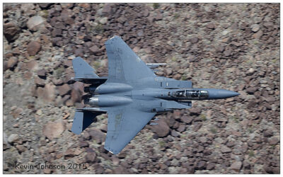
The Jedi Transition starts just west of Owens Lake at 36.403047,-118.01239. From here aircraft hug the desert floor and pull up just before the canyon to clear higher levels. From there they enter the Canyon at Father Crowley Point, and continue through the Valley and exit the valley 3 miles from Father Crowley point.

A short week in Alaska

Anchorage, Seward and Denali NP

Duration: 10 days, 9 nights
Location: ALASKA
Budget: €2,800
Miles Travelled: 1,800

The start of the trip sees us arrive in Anchorage from an early morning flight up from Seattle. Then we head down to Homer for the eagles and some bear watching out in Hallo Bay.

After this we head back up to Seward and do some day trips out on the water for wildife and a bit of fishing.

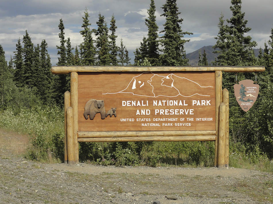
Finally we head back up to Anchorage and north to Denali National Park for some sightseeing and hiking in the area.


Day 14 – So this is a follow on from my previous weeks on the trip to date – starting off in Hawaii and then driving up the West Coast from San Francisco to Seattle. Now we are after departing Seattle early on Sunday morning at 06:00 and flying up to Anchorage in Alaska – a flight that took approximately 2h 40 minutes. We slept on the plane for a bit and just rested after the early start. We had had a nice time in Seattle and the West Coast for the past week so we were looking forward to getting off the beaten track a bit in Alaska and seeing what was out there. Now I have to say, of all the places that we were going to travel to on this trip, Alaska was the most unpredictable weather wise. I had done the research and you could expect just about anything from one day to the next. Luckily for us, we are from Ireland and that is your typical weather situation they’re going from one day to the next. When we landed that morning we got a snack at the airport and picked up some brochures and other information leaflets before heading to collect our car. We had toyed with the idea of an RV for the time that we were here but it would be wasted when we were out on Hallo Bay looking for the bears etc so we decided against it. Also there was the cost of fuel for it etc and all in all I think that it was working out at around the same cost – maybe even a bit cheaper depending on where you stay at night hotel wise.

Anyways we collected our car at the airport and got a map off the lady behind the counter and got directions to a local supermarket. The weather was a bit colder and wetter than we had expected so we decided to stop off and get some clothes and food before the journey down to Homer. The weather was not in it to walk around the city doing sight-seeing so we were both in agreement to head off towards Homer and get that much of the journey under our belt and out-of-the-way. We headed to a local Safeway store and looked around inside and made our purchases. It was the likes of a Dunnes Stores or Tesco at home for us so we browsed around the place and made some purchases. The one thing that they have here in Alaska – and the States – is a Club or Members Card – much like back home. We did not bother getting one until later in the trip and we should have got it here. There are some great offers to be had in the place for buying food for lunch and meals and they have some great discounts with the card. We got it later on and used it plenty of times before we flew onto Chicago. Anyways we got some jackets and a jumper and some hats as we were sure they were going to get destroyed with mosquito repellant spray and deet so we did not want to have to damage our good hiking clothes too much. We checked out the clearance rack in the clothes section of the store and got a few pieces for relatively cheap and then loaded up the car and started to drive South towards Seward. There were a few over taking lanes and a lot of the landmarks on the way were familiar to me as I had been there back in 2006 with the lads. I was telling Tracey of the different locations along the way that I could recall and pointing out where we stopped for photos or turned off in order to visit a local attraction or something like that. When we were about 30-40 minutes from Seward we turned off to the right and headed for Homer – I think that we were around 90km from Anchorage and it was a major junction so kinda hard to miss. We turned off there and had around 2h30 minutes to go to get to Homer according to the GPS and the road signs. We were now on the Sterling Highway or Highway 1 South. All we had to do now was kept on moving till we ran out of road – then we would be in Homer. Overall journey time was 4 hours according to the research and data that we collected online. We drove along and chatted and looked at the different views of the countryside as we made our way along in a south-westerly direction towards Homer.

We were looking for somewhere to eat along the way and there were several towns and villages in which to stop and eat but because we had an early start the last thing we wanted was a large meal – it would only make the driver tired and then it would be hard to get back on the road. The main town along the route was Soldotna – pretty much due South of Anchorage but you have to go around a spit and coast road in order to get to it. It has a local airport as well in case people wanted to fly into it and rent vehicles from there – but Homer has the same so it would probably be better to fly all the way to Homer and drive back up. We did not opt to stop here for food but keep on moving – we had some bread and lettuce and cheese and honey mustard in the car from Safeway so we got sandwiches of those as we were driving along. The tasted great and we ate and kept clocking the milage off piece by piece. It was approximately 75 miles from here to Homer or 90 minutes drive time. We stopped at a few stages to get some images of different views and locations and I saw some eagles flying over head as we were driving also but they were either high up or just crossing the road and moving on towards the tree lines or another destination. We approached the view point just outside of Homer later on that day and pulled in to take some images. Unfortunately it was quite foggy and there was low lying cloud hanging over the Kachemak Bay area so there was not a lot to see. We got back into the car and drove on into town to see the place. According to Wikepedia, Homer is a city located in Kenai Peninsula Borough in the U.S. state of Alaska. According to the 2010 Census, the population is 5,003. One of Homer’s nicknames is “the cosmic hamlet by the sea”; another is “the end of the road”. You will see where the latter comes from when you drive down to here from Anchorage or Seward. Homer is located at 59°38’35” North, 151°31’33” West (59.643059, -151.525900). Homer is on the shore of Kachemak Bay on the southwest side of the Kenai Peninsula. Its most distinguishing feature is the Homer Spit, a narrow 4.5 mile (7 km) long gravel bar that extends into the bay, on which is located the Homer Harbor. Much of the coastline as well as the Homer Spit sank dramatically during the Good Friday Earthquake in March 1964. After the earthquake, very little vegetation was able to survive on the Homer Spit. According to the United States Census Bureau, the town has a total area of 22.4 square miles (58 square km), of which, 10.6 square miles (27 square km) is land and 11.9 square miles (31 square km) is water. The total area is 52.83% water.

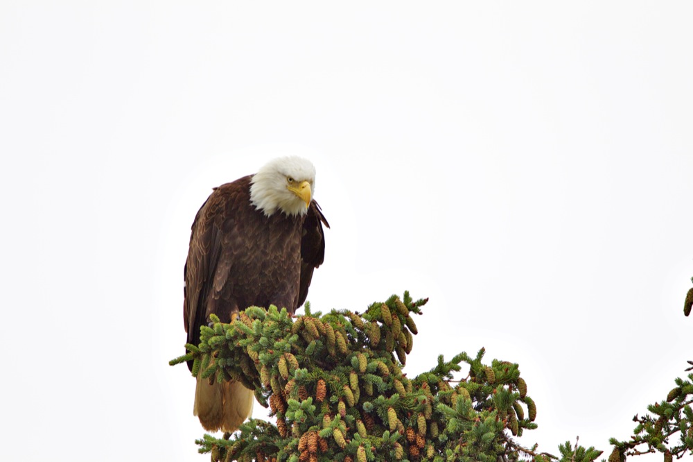
Juvenile Eagle

We drove into town and passed another Safeway on the left hand side and just up the road we saw a photographer out taking pictures in the middle of the road 🙂 Of course, being a fellow like-minded photographer, instead of blowing the horn at him or yelling to get off the road, I rolled down the window and looked out to see what had caught his interest. I immediately spotted an eagle in the tree surveying the local area. Suffice it to say that I got my camera and lens out and threw on the hazard lights and started getting some safety shots. The bird was sky lite so it was throwing off the camera with metering but once I put in some exposure compensation I was getting some nice images. The photographer was Dan was Switzerland and he had been in Alaska for a few days with his wife and was leaving that day from Homer. They had an RV and were pulled in to a lay by near the eagle nest. The female was on the nest with the chicks and feeding then – assume that the male brought back something but I missed that part. Anyways I stayed there and moved around the nest for different views and angles and took some more pictures of these magnificent birds before the male flew off – either for peace or more food for the fledgling chicks. I was really happy to have seen Dan and met him for that brief moment. We chatted about camera, lenses and things to see and do in the area – cant beat a bit of local knowledge :-). Anyways, after this, we drove down along the spit to check out the place and get our bearings for the morning as well as see what sort of place Homer is. We crossed over the bridge and found the collection point for the morning for the Hallo Bay Tour and it was currently closed. We said that we would call them later on to confirm tomorrow’s flight and the time for the pick up. We then headed to the end of the Spit and saw several more eagles along the route – mainly on top of lamp posts or flag masts. We returned the way we had come and made our way to the B&B for the night – the Pioneer Inn. It was a nice place to stay and the family were very friendly to us when we got there. We called the Hallo Bay tour office and told them we were in town and they informed us that they were away from the office for the moment and to call down in the morning at 09:00 for the departure. We looked around the town some more and then went up to a store to try get some rain clothes in case it was wet for the walk tomorrow. Unfortunately there was nothing really cheap or convenient to get so we chanced it and said we would bring an extra change of clothes for the trip and hope we were lucky. We got back to the Inn and got something to eat and decided to get an early night as we had an early start that morning from Seattle and tomorrow was going to be no different. Batman Begins was on tv so I watched that – or most of it – for the evening and then fell asleep once it was over.

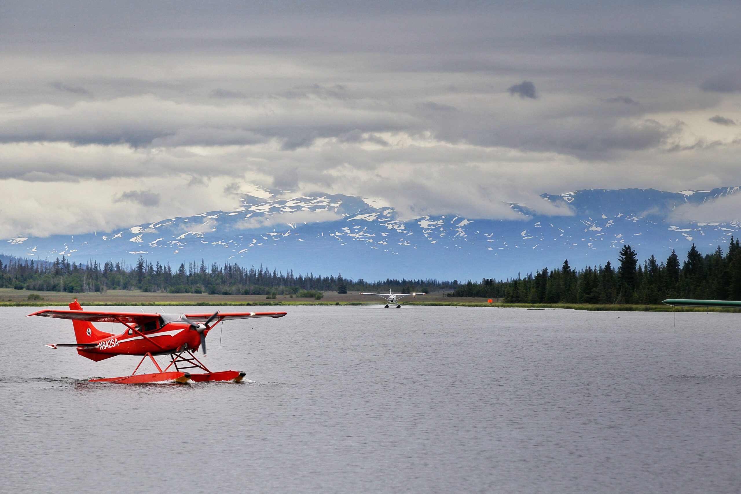
Float Plane

Day 15 – So we got up and got some breakfast and headed down to the offices for our pick up and meeting. There was no one there so we walked across the road to a coffee shop and got a cup of coffee there and asked the girl to call the Office number. She did this and they said they were running late and would be along in 20 minutes. We waited and finished our coffee and walked across to the office when the car arrived. Our phones had sketchy service when we were out and about so we could not rely on them in order to be contactable. Email was the best option. Unfortunately the weather was not co-operating with us this day – the people in the office did not know what was going to happen so we sat down and watched a DVD documentary on the bears in Hallo Bay. Clint, their pilot – arrived in around 11:00 and said that at the moment they were not flying out to the island. They said it might clear and we could head away but check in again in about 90 minutes. It was very informal to say the least and not really professional – but what could we do. We had found out the night before that there might be some eagles up around the dump so we were going to head up to there and see if we could find anything. We left the office and headed back out of toward towards Anchorage and turned off to the right before the look out point – the dump was about a mile out-of-town. I went into the office there when I arrived and asked if I could go in and see if there were any eagles about – the manager was helpful and said work away and told me where to look out for them – and we drove on in and started to scan the tree line and behind the fence. The weather started to turn pretty crap at this point and there was no point in trying to get out of the car as the place was a mess and I did not know how much the birds were used to humans. I got some shots of a Juvenile Eagle on a pile of rubbish alright in the rain and then we headed back to Homer as it was getting close to our check in time for the office. We stopped into the Safeway to get something to eat for lunch and when we were there we made a call to the office – still no change in the weather front and they said to check back again in another two hours. I did not know what this would mean re our trip – we had paid for two days and two nights out on the island looking for bears – even if we got out later on today we would have missed the whole day out there looking for bears – though it was bright till close to 21:00 hours. Anyways we took our lunch down to the Spit and sat out and ate it while looking at the locals and tourists moving around the place. We looked into some of the shops along here also and got some wet pants and coats in case we needed them for her or Seward later on in the trip. At around 16:00 we headed back to the Office and they were still reluctant to tell us what the plan was for the day – extremely indecisive. I said that it was unlikely that we were going to go out now as it was so late but they said it might clear and we might get out by 17:00. We waited just in case but when I asked about our trip and what we paid for and what we were going to get the people in there were reluctant to give me any idea of refund or compensation etc. Eventually we were told that the flight was not going so we called the Pioneer Inn again to see if they had any rooms for the night. Unfortunately they were booked out as well so we stayed in another place for the night – one that was recommended by the office. It was small and cozy and cost us another 100 dollars – a question that should have been answered by the Office re who was paying for it as we were supposed to be out on the Island so we did not have anything booked for today. However they were not willing to say what the story was with that so we headed back to the hotel and dropped off our bags. We got some nice shots of Float Planes landing on the way to the hotel the first time as well – a bit of luck really as they were coming in to land from a trip that they could get out and do that day – seemed like we were the only ones that were grounded.

We decided to go for a run along the Spit as there was not a lot else to do about the place and the whole day had been a disaster as the bears and trip went. We drove into town and ran out to the end of the Spit and back in again – seeing some eagles along the way and chatting. We saw some cyclists also and one or two other runners. We headed back to the hotel and showered and changed and then we got something to eat at Safeway and took it down to the Spit to enjoy the evening light and breeze across the bay. We walked around a bit and headed backed to the room then to check the weather online and our emails in case the Office was in touch. There was nothing from the Office and the local weather seemed ok for the morning but who can tell. We went to bed and watched a movie and hoped that the morning was going to be a bit better than today.

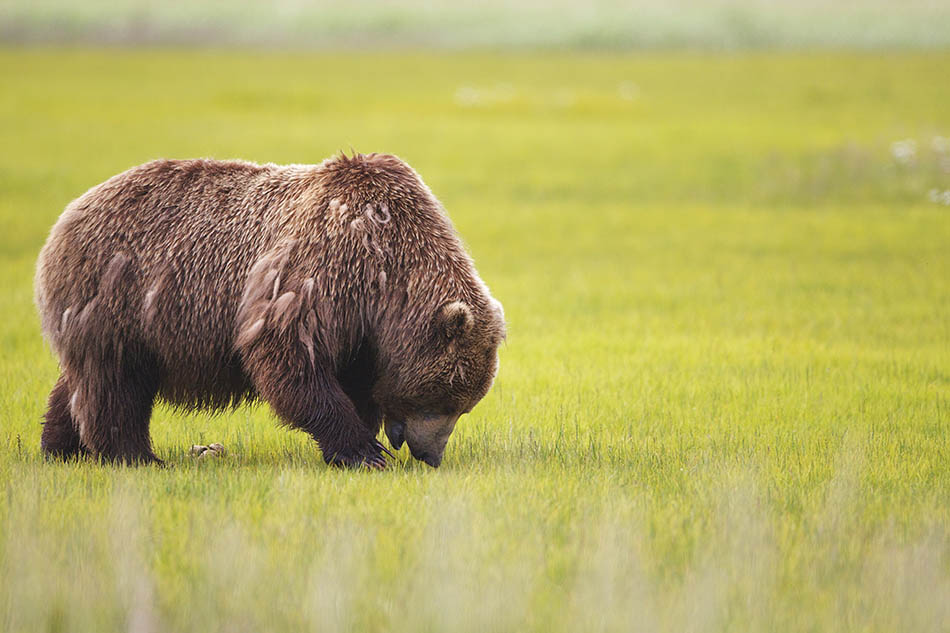
Day 16 – So we got up and checked out of the hotel. Today was our last chance to make it out to the Island to see the bears as we had to drive over to Seward tomorrow for the trips we had booked there. I had made the others aware of this as well in our conversations yesterday but the weather is the weather and there is very little that one can do about it. We got down to the office and were told that we were going to be heading out today alright – the conditions had improved a lot and we should be able to make it out without too much trouble. We were leaving the bulk of our clothes in the car and just taking some hiking gear and some camera gear and a change of clothes in case we got wet when we were out there. You had to weigh in at the office as well to determine what your overall weight was for the flight – ie you and your camera gear and you bag – so that they could determine the weight that would be loaded onto the plane. I think that you were limited to 200lbs per person – so if you are travelling with a small group you could accumulate the combined weights in case one person was bringing more gear that the others. So between myself and Tracey we had a 400lbs allowance and all was good with regards coming close to that. We loaded up our gear bag and took the camera bag onto the plane with us. There was another family travelling out for the day trip – they were from the Netherlands I think and there was 7 in their party overall. We flew to Hallo Bay first to drop off supplies for the camp and also to pick up the guide for the day – his name was Dwayne. He ran us through the safety briefing and then we were loaded up again and heading off to a small bay a few minutes flight away. As we were taking off we saw a wolf and bear on the beach hunting for salmon and clams. It was nice to see them and hopefully we were going to see a lot more bears in the coming hours. We landed down on the other beach and then said goodbye to Clint – our pilot. He was heading back to Homer with different material from camp and was going to be out later on to collect the family after their half day trip. As part of the trip, we had a packed lunch organised by the tour operators and we had some snacks of our own with us just in case. We started off walking around the area following Dwayne and his directions as we started looking for bears. After a few minutes walk we could see some of them in the meadows around the place. Even though it was late July at this time of the year the bears were still feeding on the protein rich sow grass in the meadows as well as digging for clams. The salmon had not started to fully run yet so there was little activity along the coast line – unfortunately. There was a TV crew from the BBC there as well-doing some recording for an upcoming movie release for 2014 – or so we were told by our guide. We will have to wait and see if that is right now or not. We saluted them and moved on to see our first bear and get in close and get some pictures. I had my 500mm on the 1D Mark IV and I also had a 5D Mark II full frame with a 70-200mm lens attached. At times I could use the 70-200 mm to take shots – the bears were that close. Other times I used the Mark IV as it was better able to neutralise the movements in my handholding. I did not have a tripod or monopod on the trip – or not for this part at least. In hindsight I could have used a monopod here alright and it would not have been any extra weight to carry. A tripod would have been wasted I think .We moved around the meadows and Dwayne positioned us such that we had nice background interest in the shots with the bears – glaciers, trees etc. It was very interesting to listen to him explain the natures of certain bears based on his recognition of them “he is a bully” or “she is fine and nothing to worry about”. In the 25 years that they have been running guided tours throughout the area, there have only been 4 instances where they have had to use flares to ward off the bears – guns are not allowed or permitted on the excursions. It is a pretty impressive statistic. We saw a fox off in the distance as well when we were walking around the place. It was hidden in the tall glass but Dwayne had a good pair of binoculars and I had the 500mm that was about the same with field of view.I did not get any usable shots unfortunately as I could not hold the lens still enough for the shot. We walked on and decided to have lunch shortly after the fox sighting. We all sat down in the middle of the meadow and took out or food – sandwiches, crisps and a drink. The bears have no concept of human food so they don’t know what it is like or how it tastes – and that is how the Park Service want to keep it. So you carry out what you carry in – nothing is left behind. We were eating lunch with no less than 10 bears in sight of us at all times – truly an epic moment. The only thing that was annoying were the mosquitos – they were everywhere. It did not seem to matter how much spray and repellant you had on you – they just kept on coming. We had bought some face nets before coming out to the island and they were a god send. I had a wide-brimmed hat that I wore all the time – for sun protection as well as keeping the net out of my eyes. Tracey had a peaked hat that she wore and it also worked well – we may have looked silly but at least we did not have any bites on our neck or the back of the head etc. We wore a light pair of gloves to keep the mosquitos off the hands when we were shooting the cameras or walking etc and that also worked again – again these were sprayed with mosquito repellant and citrus scented water to help keep the bugs away. We did not need gaitors or wet pants but you do need a pair of wellies or waterproof boots for crossing the river – as we did at times. The company provides these also so you do not need to bring your own – unless you are planning to do a lot of walking out there and stay just for the bears. Their wellies are ok but they are not the best for long walks – as we were doing. After about 3 hours we were changing direction and angling back towards the beach – where the plane was going to collect us. We got back to the pick up location and then Dwayne got a radio call that the plane was going to be delayed by about 90 minutes. We could sit there and wait for it or go off walking in search of more bears. Of course we went off walking again – out along the coast this time – to see if we could spot anything new. The day was warm and hot but we were trying to keep as much skin covered as possible in order to keep the mosquitos from biting us. The bite aint the worst part – it is the stinging and itching that occurs afterwards. We captured some images of yearling bears out on the coast and one walked right in past us towards to the meadows. We walked around a different route and captured some more images before heading back to the beach again for the plane. All in all it was am amazing experience and one that is truly awe inspiring – to come so close to untamed, wild Grizzly bears and be as close as 5m from them in their natural environment – lets just say you have to be there to understand!!
The others loaded up and we flew back to the Hallo Bay camp and dropped off our stuff in our cabin – a kevlar type construction that was setup there year round and could sleep 3-4 people comfortably. We met the camp cook – Tanya – who was going to be feeding us for the next day – and some geologists who were staying in the camp area and doing some research on rock formations in the area for the coming month. Normally food is at 17:00 hours each day and we were back around 16:00 in order to settle in and get the food when it is served. However there were some problems this day with food and preparations etc so it was going to be close to 20:00 hours before food was ready. So we were going to head out with Dwayne and a another traveler from Seattle for a few hours. We dropped off our bags in the cabin and got our gear ready and re-filled the water bottles. It was still really warm so there was no need for a lot of gear. We headed back down to the beach and walked up the beach towards a flowing stream where the salmon were running back towards their spawning grounds. We saw some juvenile eagles, belted kingfishers, mergaser and chicks and of course a few bears. Suffice it to say, the mosquitoes were everywhere – they were all over the place and because we were near a tree line this time, they tended to be a lot more of them about the place. We captured some nice images and videos of the bears when we saw them on the hike and got back to the camp for around 19:30 – just in time to freshen up before the meal at 20:00 hours. Tanya had meatloaf on the menu tonight – something that we had never had before so it was nice to try it out. We were quite hungry and it went down well. The guys were a good sort and we chatted and ate our meal and dessert without too much delay. Dwayne wanted to head out again with us towards the marshes if we want but we politely declined – it was a long day of walking with the gear and we did not get to drink a lot of fluid so we were a bit run down. We said that we would take it easy and rest up. We chatted to the Office inside and they told us that they could offer us a refund on our two-day trip – even though we only availed of one day due to inclement weather. We could stay out tomorrow and do a half day with the bears we were told and come in the afternoon but we were nervous as to whether the plane would fly in the afternoon due to weather. We already had plans for Seward and we had to get over there so we declined and said we would go in in the morning and get back to the office and get on the road to Seward before too long. We went to bed and watched The Big Year on the ipad that night and then fell asleep. The sleeping bags were huge and not mummy sacs so during the night we woke up cold – even though there was a heater in the cabins. So if I was going out there again I would probably bring a small light mummy sac type bag to sleep inside their bag – this would solve the problem of the heat escaping and us getting cold.

Day 17 – We got up around 07:00 and got dressed – we had been awake for a while so there was no point in waiting any longer as far as we were concerned. We repacked what we needed to and then headed into the cabin to get some breakfast. Clint was there around 09:00 and we were loaded up and in the air by 09:15 and back inside in Homer for 10:00. Tracey slept on the way in and I chatted to Clint around flying and this and that. We got back to the office for 10:30 and worked on sorting out our refund policy. Sarah – the girl behind the desk – could not really commit to anything – so we asked them to get in touch with us via email and try get it sorted before too long. It ended up taking about two months but we finally got some money back out of them re the cancellation so it did not work out too bad – it was just annoying not having anything definitely and have to wait so long for a correspondence from them. We left Homer around 11:00 and headed up towards Seward. We stopped at the view-point on the way out-of-town and the fog bank was cleared and we had a semi nice clear view of Homer, the Spit, the Bay and the surrounding areas. We continued on up the road then on the Sterling Highway to the junction that would take us to Anchorage or Seward. We ate in the car again and kept driving through out lunch. We stopped in Soldotna to get some fuel for the car alright and then get some sweets and snacks for the onward journey. We got up to Seward around 15:30 and checked into the apartment that we were staying in for the coming few days. It was called the Harbourview Inn and we were in the C street apartment. We were a little early but the room was ready so we checked in. We dropped off our bags, put the food in the fridge and then decided to go out for a walk around the place and see what it was like. We had also spotted some food stores for dinner for later so we would go back there and get something for cooking in the apartment.
After getting some groceries, we left the car at the apartment and headed out for a walk around the downtown area. We walked into town and then looked at the signs for the museum and the local shops. We walked back out towards the harbour and passed through the camp grounds. There was a little bit of activity around the place but not a lot. We saw some boats coming back in from their fishing excursions for the day and a few heading out also. The air was nice and fresh and when the sun started to set behind the mountains, the area on the other side of the water was lit up a golden orange. I took some panoramic photos of the area and then we walked up towards the harbour – where we were going to meet our captain in the morning. Once we knew where we were going for the morning we headed back to the apartment and got some dinner. Then I backed up some cards and got my bags ready for the morning. Then it was a case of watching some tv and heading to bed so that we could get an early start in the morning.

Alaskian Brown Bear

Day 18 – We got up and did a short run around the town and out the other side – walking it takes a bit of time but running you cover the distance a lot quicker. We did around 5 miles and then we were back to the apartment for a shower and some breakfast. I got my gear ready and headed down to the meeting place for the 09:00 start. We were there with plenty of time and relaxed then for a bit before the crew came to collect us for the boat ride for the day. Our captain today was going to be Tanya and we were heading out on a wildlife excursion around the area. We booked online for the trip and it cost us 200$ per person for the full day trip. There are other boat trips out there and excursions that one can do but I did some research and this one is nicely limited to smaller numbers and focuses on the photography aspect a bit more – or so I was told online at least. Lunch was also included in the price for the day so that helped. Details on their website state the following :

Our full day Small Group Whale Watching, Wildlife, Natural History, and Glacier Tour ventures deep into Kenai Fjords National Park. With over 25 years experience, we will show you the Fjords’ best kept secrets. This is a photographer’s paradise where you will see the Harding Icefield, calving glaciers, seals, Steller sea lions, porpoises, and sea otters. We will stop for lunch in front of a calving glacier, giving us ample time to witness and photograph the face of the glacier as mammoth pieces of ice thunder into the sea. A majority of the time we see whales on these wildlife and glacier tours.
During spring we are likely to spot grey whales on their annual migration to the arctic. In the summer we often encounter humpbacks, minke, and fin whales which have traveled thousands of miles to feed in the rich waters of the fjords. Orcas, also known as “killer whales”, are present in our waters throughout the year.
Most tour operators conduct their wildlife and glacier tours with groups of 100 or even 200 or more passengers. We are more interested in quality than quantity and therefore limit our group size to 15 or fewer and can arrange for tours with as few as 2 people. With smaller groups we can position the boat so everyone gets a perfect view. We take extra effort so you will never miss that photo opportunity of a lifetime.

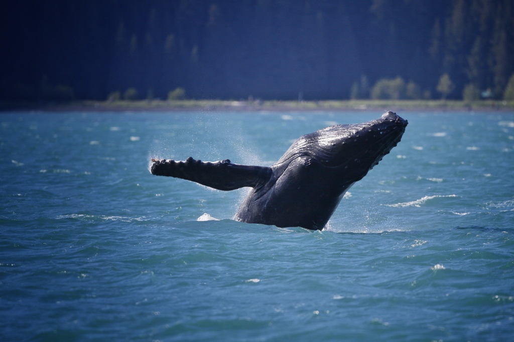
I have to say that the crew were professional and detailed in their jobs. .There were books on the boat in case you wanted to read up on what sort of wildlife you would see out there as well as framed prints of whales and other animals. The tour was really good and not too long – even though we started just after 09:00 and did not get back till close to 17:00 that evening. When we were out there, the guys went above and beyond the call of duty to get us a view of something different – going so far as to even head out to sea in order to view male, female and baby Orca whale… – very impressive. We saw Sea Otter, Humpbacks, Daal porpices flying along in front of the boat and on the way back into the harbour, the sun came out and we caught sight of a humpback breaching. You can see some more about that here and here. It was really cool and a great high to finish off the day on. We disembarked shortly after 17:00 and headed back up to the apartment. We went and got something to eat then in the supermarket and cooked back in the apartment. In the morning we were doing a similar excursion except that this time we were going fishing. We re-packed our bags as we were heading off to Anchorage tomorrow evening and had to check out in the morning before we left on the trip.

Day 19 – We got up and did another short run before we headed out to the harbour again. We loaded up the car and checked out in the reception before going down to go fishing for the day. There was a slight fog out when we left with our new Captain – Chris – who is from San Francisco originally. We were salmon fishing today and had bought our licenses before we got on the boat. This was something that we had to do first before we left in order to cover the cost of fishing in the area and be covered in case we were boarded and inspected by the rangers in the area when we were out there. According to the website the trip was something along the following lines.

This package combines the Full Day Tour with a saltwater fishing experience. There are several places along our route where a short stop guarantees catching fish. Whales, salmon, halibut, bass, along with puffins and other auklets congregate in the same area to feed on herring and needle fish. It is not unusual to have whales circling our boat and to see puffins diving while we catch fish. This package is a favorite for visitors who are interested in seeing the Kenai Fjords’ wildlife and glaciers and would also like a taste of Alaska’s famous saltwater fishing.

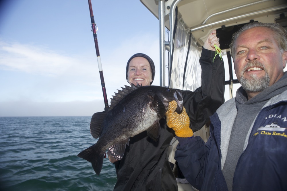
They were not wrong – we had a humpback circling up in one of the sheltered bay areas and there were a lot of puffins in another location on the way back in after the day. We caught several Salmon and our quota of Black SeaBass. Several people who come over to solely fish the waters have them filletted and dry frozen and shipped home when they are leaving. There are some companies that offer this service as well as others that ship it for you – but it can be expensive so be willing to pay for it. All in all it would be worth it – I think that it was working out at 250$ to ship 50lbs of fish back to Ireland – but that would be a lot of fish and flash frozen as well so it would keep for several days on the journey home.

We were on the boat with a family from Hawaii that were up for a few days to do a bit of fishing – you could tell that they were comfortable with the water, rods, gear etc. We learned pretty quick though 🙂 We had a packed lunch with us for today’s trip and ate that when we were hungry later on. We traveled around to several different locations depending on how the fish were biting and then around 16:00 we headed back to the harbour and Chris kindly offered to fillet some fish for us. He told us of a nice restaurant down town where they would cook it for us if we wanted. We decided to take him up on his offer and took in some salmon and sea bass and got it cooked for us. It took around 30 minutes for us to get our meal that day but it was lovely – and we had caught it ourselves. We then started to drive back towards Anchorage as we were staying there that night.
We stopped off about 30 minutes outside of Anchorage and took some photos of kite surfers on the water – I spotted them from a ways away and the sun was nice and low in the sky and I needed some fresh air to wake up from the driving. You can see some of the images here  and here in other article that I wrote. After this, we got back into the car and headed to Anchorage. We got in and found our hotel for the night – the Ramada Inn. There was a nice Scottish fella working behind the counter when we got there – Ken – and we had a good chat with him before we checked in. We got a map of the place and got our bearings before we got something to eat and walked around the main streets for a bit of air and window shopping. We headed back to the hotel and watched some tv and went to bed then as we were heading to Denali the following morning.

Day 20 – We got up early and headed out for a run – there was a bike trail near the hotel called the Tony Knowles Coastal Bike Trail and we got down onto that and headed up to the lake and bore left back towards downtown. We returned to the hotel and grabbed a shower and got something to eat before we headed down to the Saturday Market. It was just starting and we were in no mad rush so we looked around a little before we left. There were some nice stalls here with trinkets and little knick knacks and other touristy pieces. There was also an aerial display on this morning that a lot of people were heading to so the market was a bit quieter than normal. We bought some stuff for a few friends at home and then we got into the car and started to drive towards Denali. We could see the long traffic tail backs of people going to the air show as we headed North. We did not get stuck in any traffic really as we were heading along. We stopped at the Mt. McKinley viewpoint further on up the road but the cloud was covering the peaks and there was nothing there to see really. Besides there were some mosquitoes about the area so we did not stick around for too long. We headed up to Denali NP or close to it – we were staying at Carlo Creek lodge for the few nights so they were located at mile marker 224 on the highway. We stayed there back in 2006 and it was a nice place. We checked in and dropped our bags and relaxed for a little while before we headed out and down towards Denali visitor centre. We got something to eat in here and looked around the display area before we headed North towards Healy and where we were going to do some Horse Back Riding. We got up there at 16:00 hours and headed out on horse back with Alana for a few hours – and Matzo the dog. He was there to warn us of bears that might be in the area. The whole area is a coal mining area or based around that – there are some exhausted mines and some that are still active. We rode to a small cabin in the woods and had a break there and a small snack and a chat. It was nice and quiet and very relaxing – and thankfully not a lot of mosquitos. We headed back towards Carlo Creek and stopped off on the way to look in some shops and buy some souvenirs. We got something to eat and then went back to the accommodation. We stopped off a beaver lake on the way – from 2006 – but there was no activity there when we had out dinner so we headed into the cabin and chilled out. We saw a Goshawk outside alright that evening before we went to bed but there was no other activity that we could hear or see. We went to bed and got ready for the Heli Hike the following day.

Day 21 – So we got up this morning and went into the Visitor centre to look around and do some shopping. We were heading off in the afternoon for a heli hike trip up the mountains. We trekked through the wild Alaskan backcountry with an experienced local naturalist at our side. We got to explore remote areas that are normally a full day’s hike away. We were flown in via helicopter and then the four hour tour began with a helicopter flight that took us to a ridge overlooking the Yanert and Moody river valleys where spectacular vistas of the Alaska Range dominate the landscape. On our hike down the ridge, Mt. McKinley towered on the western horizon and Mt. Deborah provided an impressive backdrop to the east. Our naturalist-guide paused frequently to explain the flora and fauna and teach us how to track animals. There were three of us in the group. You can see a variety of wildlife including Dall sheep, caribou, moose and bear, as well as hoary marmots, pikas, and birds. We saw golden plovers, ptarmigan, pika, hoary marmots and of course the ever trusty Caribou. Our guide used his tripod as a set of antlers to try to trick the Caribou into thinking that we were a herd of Caribou and come closer to us – unfortunately that did not work out too well and all we saw of the Caribou was them heading in the opposite direction. We saw a golden eagle on the ridge line also and it took off and soared overhead. I spotted a hawk owl off in the distance also, quartering the land in search of food – but it was too far away for any decent shots. We walked around to a new ridge line and sat down and had a nice cup of hot chocolate and some homemade cookies that wife had made. The helicopter came to get us around 19:45 and we were back down around 20:00 and heading to the cabin for an early night after grabbing a subway.

Day 22 – We were up early this morning and finished packing our bags before we were collected for our Jeep Safari tour. Details from their website state the following:

You and your fellow adventurers will take the wheel of 4-WD Jeep Wranglers and follow your guide on a spectacular off-road journey into Denali’s backcountry. Your adventure begins near the entrance to Denali National Park where you meet your guide, receive your orientation and Jeep assignment, then head North a short distance on the George Parks Highway toward the town of Healy. Your destination is the Stampede Road. Once called the Stampede Trail, and not shown on most Alaska maps, this road was carved out of the wilderness by early miners working the area’s Kantishna gold fields and antimony mine. The Stampede Road gained notoriety recently in the motion picture, Into The Wild, directed by Sean Penn. This is the very same road that young Christopher McCandless, subject of the book, took to enter the wild. The first few miles of the Stampede Road are paved, but beyond this point your guide will lead you along some very primitive roadway providing you with plenty of bumps and dips and sways. Your Jeep Wrangler® carries four guests, and there will be ample opportunity to switch drivers so everyone can enjoy the thrill of maneuvering along this Wilderness Road. Interactive two-way radios allow your guide to explain the area’s rich history, point out interesting sights along the way, plus provide tips on the condition of the road ahead! Throughout the trip, you’ll be able to ask the guide questions and share the experience with your fellow drivers.

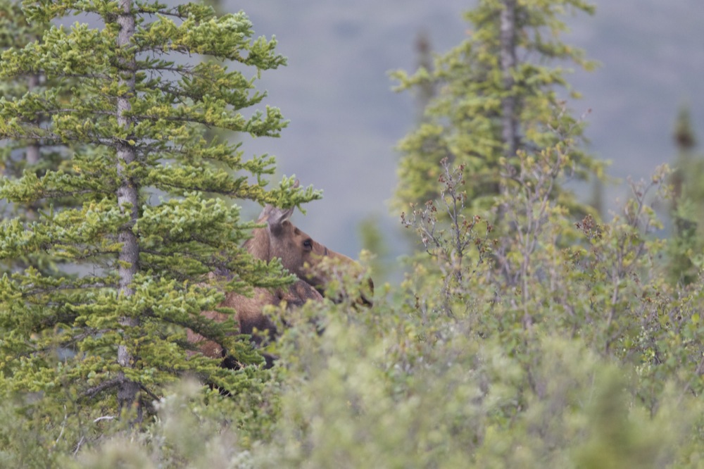
At the start of the trip we were lucky enough to come across a moose in the undergrowth. Our guide was not the best at stopping or allowing us to take pictures of the moose – we literally had to tell her to stop and let us get out and take the images. It was nice to see though and the area was safe. We got back into the jeeps and continued on on our journey. We got to the camp where we had a cup of coffee and some cookies and chatted with a company chef who was working there for the week. There were a lot of mosquitos around when we got there – there was a lot of tree cover for them. We stayed here for 20 minutes and then headed back the way we came. I stopped and got out of the lead jeep at Bobblehead Canyon – where the road was pretty bumpy. I captured some video footage of the other drives as they came through this war zone as well as further up the road at a river crossing. Click on the links before or email me if you want to get your hands on them 🙂 We got back to the cabin at 11:45 – a bit later than predicted as we were supposed to check out at 11:00. We had a quick shower and change and then checked out and left for Anchorage. It took close to 5 hours to get back down to Anchorage and we stopped for fuel along the way as well as one or two view points. We were staying in the same hotel as the other night so we knew where we were going. We checked in and decided to go for a walk. We got directions to a TGI – it was only about an hours walk away 🙂 – but the night was nice and warm and we needed some fresh air after the car ride down that day. We got some food and walked back to downtown and did some window shopping and then headed upstairs to our upgraded room – we got a suite instead of the standard room that we had originally booked – fair play Ken. There was a great sunset this night as we looked out across the train station and docks.

Day 23 – We got another run in this morning on the bike trail – a bit longer than the last day. We were back to the hotel within the hour and got a shower and some breakfast before we checked out. We had to have the car back to the airport before 10:30 so that we did not have to pay an additional charge. Our flight was delayed by approximately 30 minutes so we had plenty of time at the airport to relax. We saw a lot of tourists with flash frozen boxes that were full of salmon and other fish heading home also – the fruits of their labour for the week. We checked in and went through security and then headed to the gate and go on our plane to Vancouver, British Columbia. The flight time was around 3 hours so it would not take too long for us to get there in the end. And so end this leg of the journey… and the next one begins…. in Canada!

Recent Travels

Be sure to check out our recent reports from the other trips that we have done around the world.

Morocco, Casablance and the Sahara

Morocco, Casablance and the Sahara

Duration: 10 days, 9 nights Location: Morocco, Africa Budget: $1750 Miles Travelled: 1970KMDays: 10Dates: 22nd March 2018 to 31 March 2018Tour Company: Morocco Round TripsCurrency: Dirham (10.7:1 exchange rate)Time Zone Difference : NoneMorocco Driving Distance :...

Tunisia

Tunisia

So this trip came about because the Tokyo marathon and Japan excursion was cancelled due to the Covid-19 or Corona Virus pandemic. We got notice approximately two weeks before we were due to travel that the marathon was cancelled so we set about looking planning an alternative destination – and that destination was Tunisia.

Jedi Transition – aka Rainbow Canyon 2015

Jedi Transition – aka Rainbow Canyon 2015

The Jedi Transition starts just west of Owens Lake at 36.403047,-118.01239. From here aircraft hug the desert floor and pull up just before the canyon to clear higher levels. From there they enter the Canyon at Father Crowley Point, and continue through the Valley and exit the valley 3 miles from Father Crowley point.
A week in Hawaii

Exploring Hawaii

July 2012

Island Hopping, Surfing, and Waterfalls

Duration: 6 days, 5 nights
Island: Oahu / Kauai / Big Island, HA
Budget: $1500
Miles Travelled: 5,000

Day 1 – Ireland to SFO to Honolulu
Day 2 – Honolulu / North Shore / Pearl Harbour
Day 3 – Kaua’i Day Trip
Day 4 – Big Island – Botanic Gardens
Day 5 – Big Island – Surfing / Kona IM Course
Day 6 – Big Island / Oahu / SFO ( Red Eye)


 Day 1 – Ireland – SFO – Oahu

Day 1 – So this trip all started off in early July 2012 – just after I got married. After getting married on the Saturday and recovering on the Sunday, it was time that evening to finish off the packing and get ready to leave for Hawaii on the Monday. We had until the following Sunday to look around the Island and have a nice relaxing time at the location.
We decided to get all the travelling done on that first day .. Monday July 9th. We got a 7:30am flight from Shannon to London – touching down around 9am in terminal 1. We then proceeded to transfer over to terminal 5 where our flight was departing at noon with an onward journey to LAX in Los Angeles. The flight time duration was just over 10 hours allowing for time zone changes and the likes. We touched down in LAX at 15:00 hours and then had 3 hours to get through customs and security and make our way to the next gate for an onward flight.

We ate on the way over on the plane so we were not too pushed re food so we lined up with the rest of the tourists and locals and went through the security and luggage check. After getting through that we re-checked our bags to Honolulu and then went on to the terminal and our boarding gate. The flight was at 18:00 hours and had us in Honolulu International Airport just before 21:00 local time – there is a 2 hour time difference between the mainland and Hawaii. It took about 5 hours for us to get out there and get our luggage. We did not have any taxi or car rented on the island at the moment so we got a shuttle service to our hotel in the downtown area – the Outrigger Reef on the Beach. Be careful as to which service you choose here – we did not know any better and just walked out the front door and took the first service available to us – which in hindsight was not the best one. They took us to the wrong hotel at first and then finally dropped us off in our hotel room about 40 minutes after we were told we would get there. Generally that aint too long but when you have been travelling nearly 24 hours it is a long time. The biggest issue we had was how late they were when they came to collect us for a return journey to the airport – but more on that later!!!

We arrived at the hotel and checked in without any trouble and just decided to go to bed as we were tired from the day or travelling.

 Day 2 – Honolulu – Pearl Harbour – North Shore

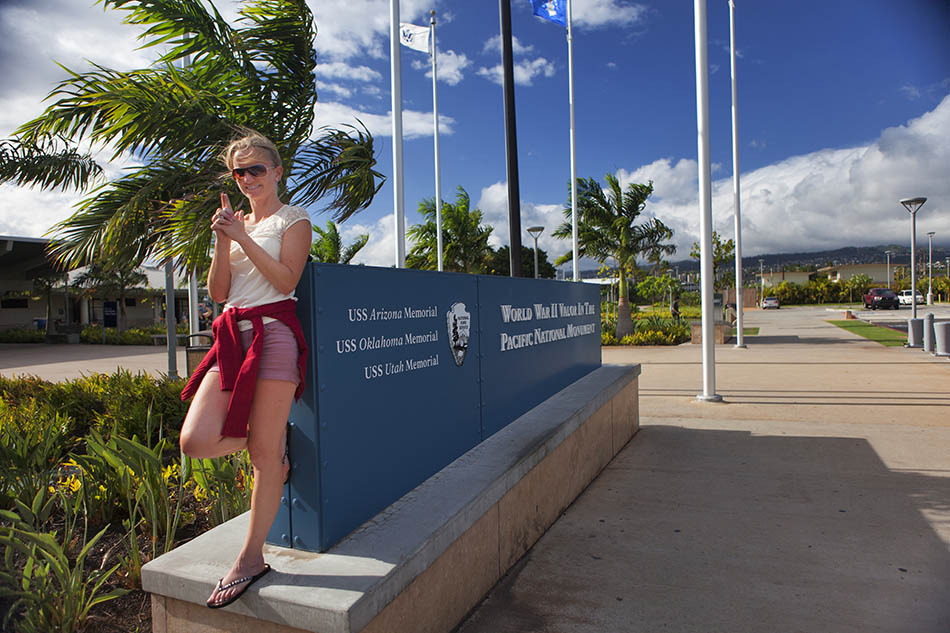
Day 2 – We awoke on Irish time .. as we were want to do. I suppose that we were kinda excited to see a bit of the island and get our bearings. We got up after a few hours sleep and the sun was up and there were people surfing on the beach in front of our hotel as 7am… we walked out onto the balcony to see the view and get some fresh air. It was nice and refreshing. We showered and got ready and headed up to the car rental place  it was a few blocks from the hotel. We called into an IHOP – International House of Pancakes – on the way and got something to  eat. I think that we picked the wrong time though as there was a big crowd there and we had to wait about 20 minutes to get a seat and a bit more to get served. We got a good feed though so it was worth it in the end. We had decided to do day rentals when we were in Hawaii as the cost of over night parking was close to 50$ per night in most of the downtown locations – so it was not worth that – the cost of the car rental was approximately that for the day so it made sense for us to rent it for the day and just drop it back that evening when we were done with it. The jet lag started to kick in though when we got to the car rental location – I had left my credit card back at the hotel and brought my driving license and my wife had her credit card but not her driving license. Avis – and all other car renters  – would not accept the cross over of her credit card and my driving or vice versa so we had to go back to the hotel and get my credit card and then go back and get the car. So we finally got our hands on our first rental car of the trip – a VW Jetta actually . The plan was to go Pearl Harbour first and then sight see around the North Shore but after reading some reviews it was either get there early in the morning or later in the evening in order to avoid crowds. We opted to head away around the North Shore for a drive and stop for some lunch along the way and then come back via Pearl Harbour.We got a map off the people in the rental agency and also had the IPAD with me that had some maps on it based on the Navfree USA package. It worked out pretty well and saved us nearly 11 dollars a day for the rental cost of a GPS unit.

So we headed eastward first and then started to progress north along the northern shore of the Island – seemingly a lot of surfers frequent this area as there are good waves for them. We stopped at a subway – of all places – and got some sandwiches there to go – and then got back in the car and headed north some more. We came upon a wedding at one stage at a beach setting – it was a bit cloudy and overcast for them so nice wedding conditions for the photographer but not so much for the locals! It was windy when we were out of the car so I can see why surfers would choose that side of the island for early morning surf locations. We stopped around 14:00 hours and got our lunch and had a nice walk along the beach before heading on again to the top of the island and then made our way back south toward Honolulu. The car rental agency closed at 7pm so we had to be back in time for that or else we were going to have to pay for over night parking as well as take the car for another day. We got back to Pearl Harbour around 16:00 hours but we had just missed the last tour. Unfortunately we did not get to go inside though Photographers need to beware as security will not allow you to take a camera bag – or bag of any form – inside. They say you have the option to store your bag and gear in nearly lockers but who wants to put a camera worth a few thousand dollars/euros/pounds into a locker. There has been break ins reported re tourist rented cars that are parked in the parking lots outside so that was not too comforting either. And the security don’t like you going in with two DSLR’s hanging off you either – it is one camera so bring a zoom lens that will cover a wide range if you have it – as opposed to a 24-70 and a 70-200 say. They don’t like making it easy eh. Here is some information that I found online that might be of interest

“Pearl Harbor and the USS Arizona Memorial remain top tourist destinations in Hawaii with over 1,500,000 visitors annually. The addition of the Battleship Missouri and the 1999 opening of the USS Missouri Memorial has further enhanced the importance of this historic area.

 The best time of day to visit the Memorial remains early in the morning before the tour buses arrive.

 The USS Arizona Memorial Visitor Center is open daily from 7:30 a.m. to 5:00 p.m. Interpretive programs, including a 23-minute documentary film about the attack and the boat trip to the USS Arizona Memorial, begin at 8:00 a.m. (7:45 a.m. in the summer). The last program each day begins at 3:00 p.m. The Memorial is closed on Thanksgiving, Christmas, and New Years Day.

 Allow 75 minutes for the tour. This does not include time waiting for your tour to begin. Use that time to enjoy the USS Arizona Memorial Museum or waterfront promenade.

Following the events of September 11, 2001, new security regulations have been implemented. No purses, handbags, backpacks, camera bags, diaper bags, or other items that offer concealment are allowed in the visitor center or on the Memorial tour. Strollers with pockets and compartments must be empty before being allowed in the visitor center. Personal cameras are allowed.

Baggage storage is available for a small fee at the nearby USS Bowfin Submarine Museum & Park and visitors are encouraged to use it. 

Visitors are strongly encouraged either to leave prohibited items at their lodging or lock them in their car trunk before arriving at the parking lot. Theft of items from rental vehicles is common in Hawaii, however, bicycle security patrols the USS Arizona Memorial parking lot.

Anyways we got some images at the location and then headed back to the car rental location to drop off the car and head back to the hotel. We walked around the city some then and grabbed something to eat and went to bed early enough – due to the  early morning start and the jet lag we were starting to feel it now. And besides, tomorrow we were off to Kaua’i to see the Island for a day trip!!

 Day 3 – Kaua’i day trip

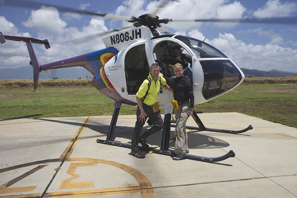
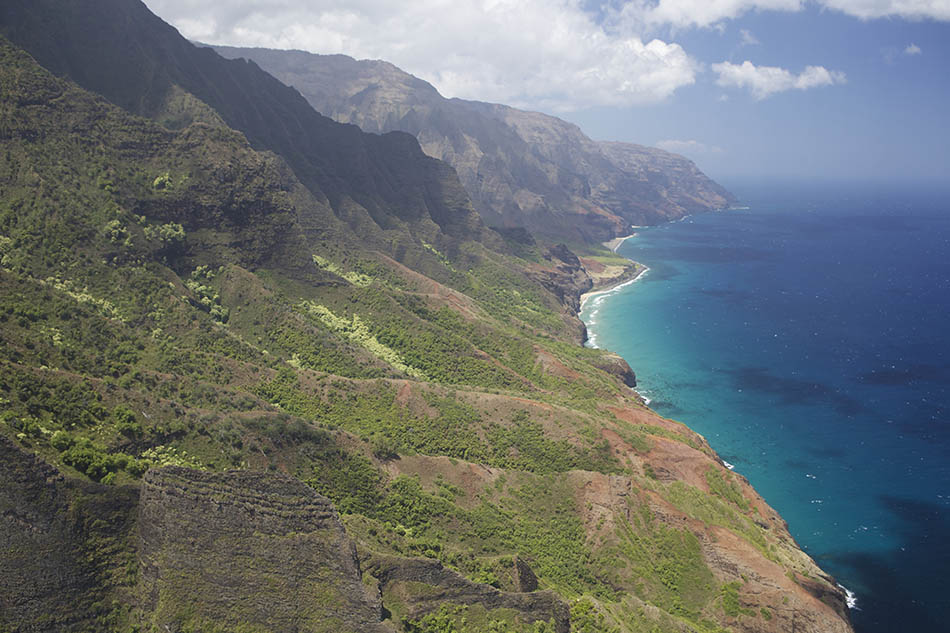
Day 3 – We were up early because we had a flight to get at 08:05 in the morning. I can’t remember the bus company that brought us in on the Monday night but we had already booked a return ticket with them so we did not know what we were letting ourselves in for. I had a missed call from them the day before at the hotel – they were looking to confirm the pick up time for us for the following morning. We asked them to come and collect us at 5:40am – it was every 30 minutes and it would take another 25-30 minutes to get out to the airport because of stops and locations. Anyways we were downstairs at 05:40 and there was no sign of the shuttle. There was still no sign of it at 06:00 or 06:15. I called the agency and they told me it was on the way. I explained that we had a flight – they said it was on the way and would be there in the next few minutes. It eventually arrived at 06:25 to take us to the airport. I asked the driver what took him so long and he told me that I was not one of his scheduled stops – he was re-routed from another pickup to collect it. I feel bad for the drivers cos they get a lot of crap but the company was really bad – once I get the name of them I will post it here so that you know to steer clear of them. My advice is to get a reputable company that will be on time and collect you or get a taxi. There were others on the bus that were in the same boat as us that morning. Anyways we got out to the airport and checked in and flew over to Kaua’i – approximately 30 minutes away. I had most of my camera gear in the bag with me – using a Think Tank Airport International – that I bought specifically for this trip. I had – and still have a -a MP1 – a Moose Peterson bag up to this for my 500mm lens. But I was told that it would not protect my gear adequately on the Alaska leg of the journey so I did some homework – and shopping – and got the Think Tank instead. Anyways our bags were ok for check in and it fit fine in the overhead bin – even though it was overweight 🙂 We landed and collected our car for the day and headed to Jack Harter Helicopter tours for our flight at 11am. I did some research before I booked with these guys and found their reputation to be good and the reviews excellent based on what I read. After doing the tour with them, I have to say that I was glad we went with them. We went up in the Hughes AStar 500 – with no doors. Again this was purely from a photography point of view…no glare when shooting out the windows as there was no doors. Another plus was the wind and air when you were flying along – whether it was along the Na Pali Coast or in through the canyons that are spread all over the Island. Approximately 80% of the island is inaccessible unless you are using a helicopter or a boat. Only 20% has road access and some of these are via 4×4 vehicles. We arrived 45 minutes prior to departure to get a quick safety briefing and then headed to the airfield where we were loaded onto the helicopter in a specific order. This had to do with the weight distribution of the passengers – to make the flight more enjoyable and safer for all involved. We spent an hour flying around the island and you don’t feel the time going. Be sure to check out some of the images in the gallery below. After we landed and got back to the registration area, we headed off North West to the Koke State Park to see some on the lookouts that we had spotted from the air earlier – a different perspective.


Some research that I found online stated the following :

“A must see for all visitors to Kauai is the amazing Waimea Canyon. Ten miles long, two miles wide and 3,600 feet deep, Mark Twain nicknamed Waimea Canyon the “Grand Canyon of the Pacific.” With its deep reds, greens and browns, each created by a different volcanic flow over centuries, many feel that is much more colourful than the Grand Canyon. The canyon itself was formed by the Waimea River as it cut its way from Alaka’i Wilderness Area to the ocean. Waimea Canyon is located in the western part of Kauai. Two roads make their way up to the canyon, both from the southern part of the island – Waimea Canyon Road (State Highway 550) from the town of Waimea and Koke’e Road (State Highway 55) from the town of Kekaha. Both have a number of viewpoints offering excellent views of the coast and the island of Niihau. My suggestion is to take one road up to the canyon and the other down. It will take 30-45 minutes to reach the first of several lookouts from which you can view Waimea Canyon. Be sure to stop at the Waimea Canyon Lookout, the Pu’u Ka Pele Lookout with its excellent views of Waipo’o Falls and the Pu’u Hinahina Lookout. Beyond Waimea Canyon, the highway enters Koke’e State Park and the Ku’la Natural Area Reserve. Koke’e State Park is over 4,000 acres with about 45 hiking trails some of which head into Waimea Canyon and some of which are short hikes to non-canyon overlooks. The Koke’e Museum is well worth a stop. The road ends at two lookouts for Kalalau Valley, one of the spectacular valleys along Kauai’s Na Pali Coast. There are two lookouts for the Kalalau Valley, the Kalalau Lookout and the Pu’u o Kila Lookout which marks the beginning of the Pihea Trail which leads to the Pihea Overlook and the Alaka’i Swamp Trail. Weather conditions can make the road and trail very dangerous in this area.”

 We stopped in a town on the way to the State Park and got some food for the journey and had a packed lunch up in the trail when admiring the views. It was pretty spectacular. Once we were done with the park we headed back to the airport to get our flight to Honolulu at 19:55 and then got a different shuttle service back to the hotel. There was a call phone inside at the baggage claim so we just picked it up and dialed their number and they told us to go out the exit, turn right and wait 5 minutes and someone would be over to collect us. They were, they dropped us off in the hotel within 25 minutes and found it first time and that was that. We walked around the downtown area some more and got something to eat before calling it a night. We were off to the Big Island tomorrow for a few days.

 Day 4 – Big Island / Botanic Gardens

Day 4 – So the original plan was to head out to the airport and leave our bags there in a storage locker for the few days that we were down on the Big Island… however we were told that the storage lockers were no longer there and working. It was a good thing that we checked into it when we were flying to Kauai the day before. Anyways, instead of leaving it at the hotel we decided to take it with us to the Big Island. So we packed all of our stuff up and checked in the bags. It cost us approximately 22$ to check each bag so it was not too bad considering. I am sure that a locker for two days might have been more expensive. Our flight left at 08:18 in the morning and we arrived at 09:08 into Hilo Airport on the Big Island. The plan for today was to spend the day with a pair of photographers that live on the island and do some shots and tours with them. I found them online via google searches etc. Their website is located here. Mary and Ken were the names of the photographers and they have been living on the islands and taking images for over 20 years now. The one thing that I did not do – and did not really know about – was tell them what I wanted to photograph. We ended up going to the Botanical Gardens and got some nice images – as well as got some nice mosquito bites 🙁 . You will need a tripod and some form of mosquito repellant – as well as some long sleeve clothes to keep the mossies at bay. We spent a few hours walking around the place and then it started to rain. It was not really a wet rain per say due to the humidity of the place but it would do damage to your camera gear if you don’t have rain covers for them. We headed back to the car and drove around the island some more before going back to the airport and collecting our rental car – we picked it up a bit early and headed across the Saddle Road over to the other side of the island to Waikaloa – where we were staying for the night in the Paniolo Greens Resort – a golf course of sorts. We were trying to get across for the west coast for the sunset but alas that was not going to happen – we left it too late – so we captured this image when we were driving into the area and then just headed to the accommodation and checked in. Thankfully it was a fully furnished apartment with a kitchen and kitchen area. So we headed out to the local supermarket – that closed at 21:00 – and got to purchase some food that we ate for a late meal before going to bed. We did not have any plans for the morning so it was a case of taking it easy and resting up.

 Day 5 – Kona / Star Gazing Tour

Day 5 – We had nothing on the cards for today – the main plan was to go to Kona first off and do a surf lesson but when we headed down there – approximately 30 minutes drive from where we were staying – we could not locate the surf shop. We looked around for a bit but to no avail so we headed down onto the beach instead and chilled out for a few hours. It was nice and quiet and not too busy and sunny – what more can one ask for!! We headed back to the accommodation and went for a short run in the afternoon – it was very hot out and there was not a lot of options for us on places to go but we headed up the main road that we drove in on the first night – there was a bit of a hard shoulder and it was either that or head down towards the Queens Marketplace – so uphill to begin with or end – we choose at the beginning. We ran for about 45 minutes and then back to the accommodation and grabbed a shower and got ready for the Star Gazing Trip that we had planned for the afternoon. This was really cool and one of the main highlights of the week that we were out here – we both agreed on this. Once this was done we got back to the apartment and went to bed as the following day we were heading back to the main island of Oahu and hoping to catch a red-eye flight to San Francisco that night.

 Day 6 – Big Island / Oahu / SFO

Day 6 – We got up and did a short run before checking out and heading on our way. We decided to head back to Hilo via the Northern Route on the island and go the scenic way as opposed to the Queens Highway. We did our run in Kona and used the showers on the beach front to wash afterwards. They were cold water but it was nice as the weather was so warm when running that it was a great way to cool off after the run . Then we headed back some of the Queen’s Highway where the legendary IRONMAN is on each October – and continued north past Waikaloa. We stopped along the way to have some lunch and then arrived at Hilo airport an hour early for our flight. We were lucky because Hawaiian Airlines had moved the flight time up an hour so we were fortunate to be back there and able to catch our flight. There was no communication via email to alert us to the change in schedule so we were happy to get on the plane and make it back to Oahu. We arrived in Honolulu International Airport and checked our bags in again for the San Francisco leg of the flight that was departing at 21:00 from Honolulu International Airport. Thankfully we did not have to change airports or terminals. We paid our checked baggage fee – approximately 45$ for the two bags – with a weight restriction of 50lbs per bag – and then went through security and got something to eat before boarding the plane and heading into the mainland for the next leg of the honeymoon.


Recent Travels

Be sure to check out our recent reports from the other trips that we have done around the world.

Morocco, Casablance and the Sahara

Morocco, Casablance and the Sahara

Duration: 10 days, 9 nights Location: Morocco, Africa Budget: $1750 Miles Travelled: 1970KMDays: 10Dates: 22nd March 2018 to 31 March 2018Tour Company: Morocco Round TripsCurrency: Dirham (10.7:1 exchange rate)Time Zone Difference : NoneMorocco Driving Distance :...

Tunisia

Tunisia

So this trip came about because the Tokyo marathon and Japan excursion was cancelled due to the Covid-19 or Corona Virus pandemic. We got notice approximately two weeks before we were due to travel that the marathon was cancelled so we set about looking planning an alternative destination – and that destination was Tunisia.

Jedi Transition – aka Rainbow Canyon 2015

Jedi Transition – aka Rainbow Canyon 2015

The Jedi Transition starts just west of Owens Lake at 36.403047,-118.01239. From here aircraft hug the desert floor and pull up just before the canyon to clear higher levels. From there they enter the Canyon at Father Crowley Point, and continue through the Valley and exit the valley 3 miles from Father Crowley point.