Morocco, Casablance and the Sahara

Morocco, Casablance and the Sahara

Duration: 10 days, 9 nights
Location: Morocco, Africa
Budget: $1750
Miles Travelled: 1970KM

Days: 10
Dates: 22nd March 2018 to 31 March 2018
Tour Company: Morocco Round Trips
Currency: Dirham (10.7:1 exchange rate)
Time Zone Difference : None
Morocco Driving Distance : 1970KM approx


Day 1 – SHANNON – STANSTED

We took an evening flight from Shannon to Stansted with Ryanair. Departure time was 21:15 and we arrived around 22:40 and collected our bags. We got a 3 pound shuttle to the airport hotel, checked in and got to bed around midnight. The shuttle took approximately 5 minutes to get the to hotel and left every 30 minutes .

Day 2 – STANSTED – MARRAKESH

Up at 03:00 to get the 04:00 shuttle back to the airport. This was the first shuttle of the morning. We checked in our bags and proceeded to the gate. No problems with bags or luggage thankfully. Flight time was three hours 30 minutes to Marrakesh. We arrived around 09:45 and went through passport control and got our luggage. Customs checked our bags for drones etc so be sure not to bring any. There is a nice little app called Airmap that you can download for iOS and Android that will tell you the rules and regulation of a country you are planning to visit and if it is allowed to bring a drone with you. We got outside and waited for our collection. The tour operators cannot go inside the airport so you need to exit in order to get collected by your company. Our company was late so we called them and eventually got collected and driven to the Riad in the old town or Medina. We checked in to the Riad Anika around noon and left our bags there. We put the batteries on charge and headed out for a tour of the city with a local guide at 14:00 hours.

Everyone talks about TIA – This is Africa – re timing etc so be prepared to wait around for drivers or guides or tours to run on time according to their website. The weather was nice and warm today so we met our guide at 14:00 and started a tour of the old city – the Medina – in Marrakesh – which is known as the “Red City”. Marrakesh is a former imperial city in western Morocco, a major economic center and home to mosques, palaces and gardens. The medina is a densely packed, walled medieval city dating to the Berber Empire, with mazelike alleys where thriving souks (marketplaces) sell traditional textiles, pottery and jewelry. We visited several main attractions in our afternoon including :

    • The Koutoubia Mosque, which is an old monument built under the reign of the Almohad Caliph Yaqub al-Mansur (1184 to 1199). A symbol of the city, and visible for miles, is this Moorish minaret of the 12th-century. This monument inspired other buildings such as the Giralda in Seville in Spain and the Hassan Tower in Rabat.
    • The Bahia Palace was next on our list. This Palace was built in the late 19th century and was intended to capture the essence of the Islamic and Moroccan style.
    • Madrasa Ben Youssef. This Coranic school is named after the Almoravid Sultan Ali Ibn Yusuf (reigned 1106–1142). Madrasa Ben Youssef is the largest in all of Morocco.
    • The Saadian tombs, which is a site that dates back to the time of the sultan Ahmad al-Mansur (1578-1603). The tombs were discovered in 1917 and were restored by the Beaux-arts service :
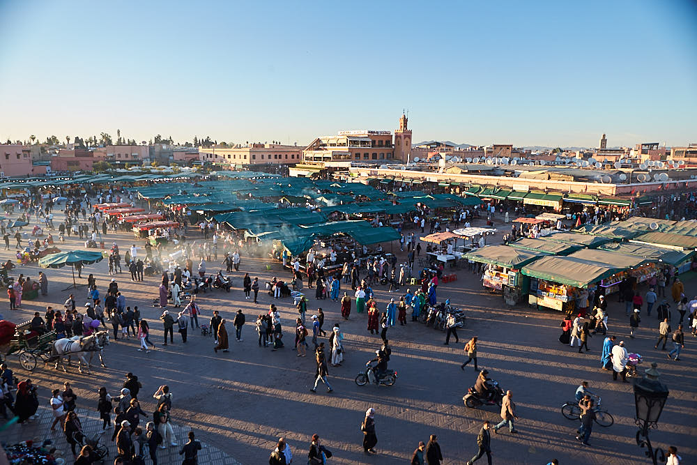
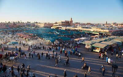
    • The world famous Jema El Fna Square where we enjoyed amazing performance of traditional activities by storytellers, snake charmers, peddlers of traditional medicines and the markets. Beware the hawkers and snake charmers – they will give you the snakes to take pictures with and then ask for 200 DH (approx 20 euro) or if they see you taking pictures of other people with the snakes they will harass you for money because you took a picture or video.

After this, we got some dinner, had a drink in the glacier bar overlooking the Jema El Fna square as the sun set and then made our way back to the Riad – approximately 15 minutes walk or 1 mile away.
Day 3: MARRAKECH – CASABLANCA – RABAT (330KM)

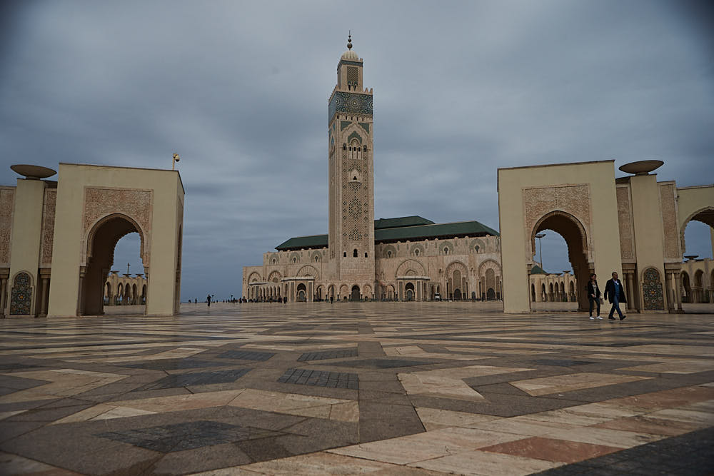
After a good nights sleep we got collected around 08:00 and started out on the three hour driver to Casablanca (245KM due North). The roads were good and the weather was nice. One thing that we noticed and were a little surprised by was that everything was so green outside. We stopped for a coffee half way and the lads had a nice crepe and Nutella to keep the hunger at bay. Arrived in Casablanca around 11:15 We visited the famous and the biggest Mosque in Africa, Hassan II, which was built between 1987 and 1993. It is very impressive and vast. We spent an hour here walking around and taking pictures. The last tour at the museum started at 11:00 so we missed this. The tour of the Mosque was not until the afternoon. Check the times before you arrive if you are interested in partaking in either. We then headed to Ricks Cafe – from the movie Casablanca – and got some lunch before driving to Rabat, the capital of Morocco. It took just over an hour to get to Rabat and meet our local guide, Mohamed.

We visited the Royal Gates built in 1864, and enjoy the charming garden of Chellah, surrounded by walls and beautiful defensive gates, built between 1310 and 1330. Later we stopped at Mohamed V Museum built in 1972, and then visited the tombs of Moroccan kings Mohammed V, who died in 1962, Hassan II who died in 1999, the tomb of Moulay Abdullah the uncle of Mohammed VI and Hassan Tower which was built in 12th century. We explored the Oudaya Kasbah which was built in 12th century and served as a military base for the Almorabits army in their defence against the Spanish army. The roof of the Kasbah allows a stunning view of the surrounding area. We also saw the 240km long Abi-Regrag river, located in western Morocco between Rabat and Sala. Overnight in Rabat at the Riad Dar Dar. We had to walk down a few streets and back track a little before we found the Riad – nestled away down some narrow alley and walkway. It was nice inside and we were greeted with the standard Moroccan Tea welcome before checking in.

We got dinner in the Riad and walked around the city’s market streets and bought some trinkets before retiring for the night.

Accommodation : Rabat :www.riaddardar.com
Day 4: RABAT – CHEFCHAOUEN (300KM)

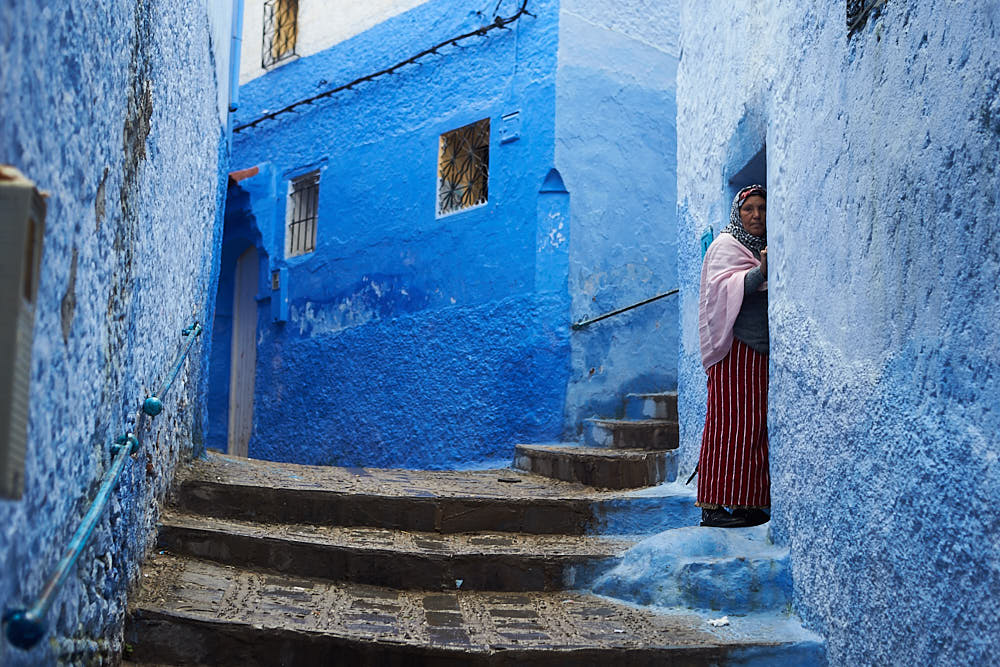
After breakfast we will drive to Chefchaouen, the blue city, through the cities of Khnetra, stopping in Ouazzane, passing by spectacular scenery with cedar, oak and almond trees. We arrived in Chefchaouen around lunch. The day was wet and damp all the way to Chefchaouen. The road had a lot of switch backs, twists and turns and narrow sections and there was a lot of climbing and descending. It is worth taking your time and stopping often to get some air and not get sick. The travel time was around 5 hours from Rabat – including stops.

In the afternoon, we looked around the Blue City. We had lunch in the Aladdin Restaurant in one of the main squares before exploring some more. The rain cleared off but the clouds remained and the temperature was lower than Rabat so we had a jumper and jacket on us for the walk around. Set against a wide valley and nestled between two peaks in the stunning Rif Mountains, the isolated town of Chefchaouen is a surprising delight. Much of Chefchaouen was recreated by Andalusian refugees escaping the Reconquistia, so its striking blue and whitewashed houses, red-tiled roofs and artistic doorways give it the feel of the Spanish hills. We spent the rest of the afternoon exploring the sights, sounds, and smells of the medina, the shops in the square selling woven goods and small sweets, and the town’s famous goat’s cheese. Herds of goats wander the sparse hillsides that surround Chefchaouen, and their cheese is sold in great fresh rounds in the street markets. Within the plaza is the walled fortress of the Kasbah – where you can wander through the tranquil gardens inside, visit the ethnographic museum, and soak in wonderful views from the rooftop. Around 18:00 we visited the Ras el-ma, where the city’s fresh water springs from the mountain. There is a path up the mountain here to give you a panoramic view of the city.

We returned to our accommodation for the night, got some dinner and watched a movie before preparing for the drive South towards the desert the following day.
Day 5: CHEFCHAOUEN – VOLUBILIS – FES (250KM)

We got up around 06:30 and did an early morning sunrise walk around the Blue City and saw it come to life. After breakfast we descended from the hills and traveled south through the centre of the peninsula towards the sacred pilgrimage town of Moulay Idriss (approximately 3 hours). From here it’s a short journey out to the World Heritage site of Volubilis – meaning Morning Glory. The remains of this Roman city make an undeniably impressive sight as they came into view on the edge of a long, high plateau. We took a 45 minute tour around the arches, basilicas, and superb mosaics along the Decumanus Maximus, many of which remain intact. We then drove onto Fes, arriving there around 14:30. Fes is the spiritual heart of Morocco.

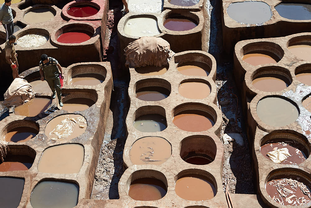
We collected our guide at the Blue gate and started our tour immediately. We started in the Medina – one of the world’s largest walled-in cities.  In the south west wall of the medieval Medina is a beautiful looking entry, the Bab Bou Jeloud. It gives excess to narrow streets that are lined up with little stores that sell fresh fruits, spices, woven Berber carpets etc.  This medina is very large, approximately 3 km and therefore one of the largest medina´s of the world.   We visited the El Qaraouiyyin Mosque, a traditional school, the place Nejjarine and the tanneries. At the tanneries you can watch locals work on skins of goat, lamp, camel and cow, in small clay pits. Sheep is cheap is the famous saying from the tanneries re the hides etc. We saw the Royal gates and had a nice panoramic view of the city before checking into our Riad. There was a problem with the sleeping situation in the Riad and the owner was not very accommodation. We had booked a twin bed and they only had a double available – according to them. Then dinner in Cafe Clock near the Blue gate and walked back to the Riad and slept.
Day 6: FES – MIDELT – ZIZ VALLEY – MERZOUGA (420 KM)

Today was a long day with a lot to see and do. After breakfast in the Riad, we drove south to Ifrane and Azrou through the Middle Atlas Mountains. The air was crisp, clean and fresh. You can feel the altitude when stepping out of the van. The Berber name of Ifrane means caves and it is nicknamed in Morocco as a little Switzerland since it is a very green town and is a ski resort in the Middle Atlas region of Morocco because of its high altitude at 1665 meters. Ifrane is famously known for the Brotherhood Private University, established in 1997 by The King of Morocco Hassan II and the King of Saudi Arabia Fahd – where all classes are taught in English. It is an international university. After Ifrane, we stopped at the cedar forest where we saw the Barbarian Apes in their natural habitat. Then we drove through the Tizi Ntalghamt pass to Midelt. Midelt is in the Middle Atlas and is called “the apple capital”. We got lunch here before traveling along the magnificent Ziz Valley oasis carved through volcanic rock. The Middle- Atlas offers some beautiful views. . Upon approaching Errachidia we saw the scenery change to a dessert environment. Onward we traveled through Erfoud, Rissani and we ended our drive in Merzouga . We arrived here around 17:30 that day.

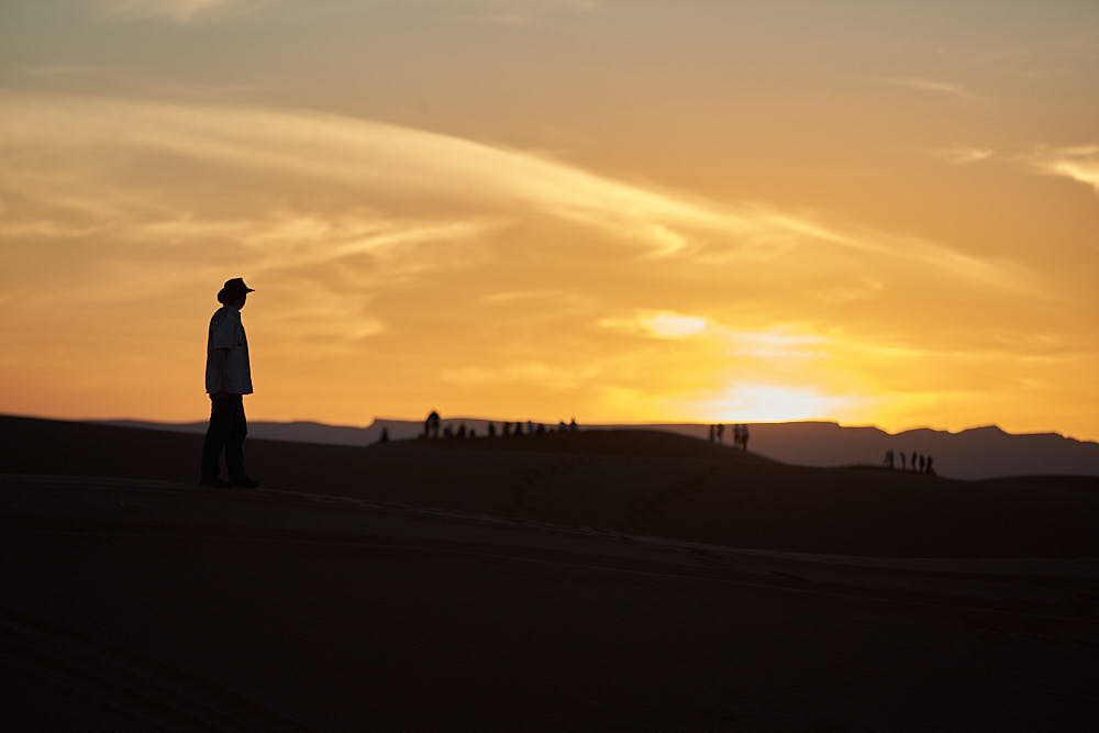
In Merzouga, we mounted our camels and headed off into the Sahara for a spectacular sunset at the Erg Chebbi Sand dunes.  Merzouga is the hometown of the Alaouist dynasty, where Moulay Ali sheriff started to unify Morocco under his red flag in the beginning of the 17th century. The camels brought us to a camp in  the middle of the Erg Chebbi Sand Dunes. These are the highest sand dunes in North Africa. The camel trek to the camp takes about 60-90 minutes depending on your schedule. Some tour companies get you to camp within 60 minutes and let you climb the closest dunes to see the sun set whereas others will stop en-route and allow you to dismount and enjoy the sunset away from camp.  Here, in the middle of the desert we experienced a magnificent sunset and afterwards the sky came alive with stars. .We spent the night in the camp with dinner and live music in the middle of the Sahara.
Day 7: MERZOUGA – RISSANI – ERFOUD – TODGHA GORGES – DADES (280 KM )

We got up for sunrise in the Dunes followed by breakfast and some sand boarding. Then we drove some quad bikes for an hour to get back to town before heading towards Dades. We left Merzouga and headed for Rissini – approximately 30 minutes drive. This silent town was once the ancient capital of Tafilalet and its location is at a crossroads between north and south Morocco. It brought the city to an important status of a former major caravan center. Up to now Rissani remains a major commercial center in the region, with a large souk, particularly lively on Tuesdays, Thursdays and Sunday. It was noted for its leather and goat skin trading in ancient ages. The souk is busy on the other days also and worth a walk around to experience the environment and setting.

After this we traveled to Erfoud. Fossils are a major industry in Erfoud – some 350 million years ago the region around Erfoud was a part of the huge ocean. We got a tour of the facilities and saw how they mine and shape the fossils once they are excavated. On the way to the Todgha Gorges we passed the palm trees groves approx 127 km from Rissini. The great canyons of Morocco  – the Todgha Gorges – are situated beyond the central high Atlas Mountains. Here, the contrasting landscapes remind visitors of the Colorado, with its high plateau, its gorges and great canyons, and its peaks sometimes splintered by erosion. Several peaks in this area exceed 4000 m, with Jbel Saghro 2500 m and Jbel Mgoun at 4068 m being the highest peak in this part of the High Atlas. If you look up, you might see climbers scaling the different peaks. The area is populated by Berbers. In the Todgha Gorge we walked through the area and took some pictures before getting back on the road to the next stop. Finally we drove to the Boumalne Dades where we spent the night. Dinner was included this evening – a buffet affair – followed by a walk around the grounds before retiring for the night.


Day 8: DADES VALLEY – OUARZAZATE – AIT BEN HADDOU – MARRAKECH ( 350 KM )

We got up and had breakfast and were back on the road for 09:00. We drove along the road of 1000 kasbahs, since there are enormous Kasbahs on both sides of the road. Some of those old fortified houses are restored but unfortunately a lot of them are in ruins. We drove first to the Dades gorge & valley. Here you saw the rock formations “human bodies, fingers of monkeys “. After a stroll through the impressive Dades Gorge, we’ll drove on to Ouarzazate passing by the valley of the Roses. This valley provides some of the most spectacular scenery of the south, this is where a large part of Morocco’s rose and rose water production occurs. We stopped for a coffee and bought some curios in the local shops. This valley gave birth to a rose from which locals produce different cosmetic products like soap, perfumes and skin creams. Locals here celebrate this rose by organizing a national festival at the end of April every year. We continued along the road of thousand Kasbah to the oasis of Skoura to visit the Kasbah of Amredil. Our trip continued to the city of Ouarzazate, a city of vibrant culture and artistic traditions.

We stopped here for some lunch. First we visited the museum with cinema props and sets from the Hollywood movies. Entry cost for the visit was 30 DH per person. Ouarzazate (Hollywood of Africa, Noiselessly town, The door of the desert), is a city situated in the middle of a bare plateau, south of the High Atlas Mountains. It is mainly inhabited by Berbers, who constructed many of the prominent kasbahs and building for which the area is known.


After lunch we visited the fortified city of Aït Benhaddou, built in the 11th century. Once up on a time this Kasbah was the former caravan route between the Sahara and Marrakesh. It is situated on a hill along the Ounila River and has some beautiful examples of kasbahs, which unfortunately sustained damage during each rainstorm and windstorms. Most of the town’s inhabitants now live in a more modern village at the other side of the river; however, around five families are still living within this Kasbah.

Aït Benhaddou Kasbah has been a UNESCO World Heritage Site since 1987 and several films have been shot there, including Lawrence of Arabia (1962), Time Bandits (1981), The Jewel of the Nile (1985), Kundun (1997), Gladiator (2000) and Alexander (2004). From this beautiful fortified house we went west to the city of Marrakech. It is called the “Homeland of God in Berber”. The ramparts of the town are nearly 30 kilometers long. Then we drove through the Atlas Mountains and saw amazing views. The roads were windy and rough in places so the going was slow and easy for the most part. After driving back over the winding Tizi-n-Tichka pass we arrived back to Marrakech around 21:00. We were staying in the same accommodation as the first night.
 

Day 9: MARRAKECH – ESSAOUIRA- MARRAKECH (400 KM)

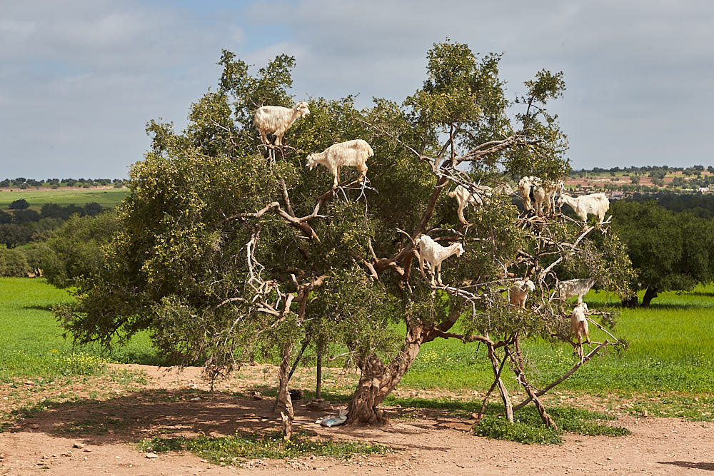
We contacted a tour company earlier in the week and booked a day trip to Essaouira for our last day. The company was late in starting, late getting to the destination and thankfully left on time to get us back home. We drove for nearly four hours with all the stops and getting out of the city. We arrived in Essaouira at 13:00 after stopping for a coffee, a photo of the famous goats in the Argan trees and the shop showing the Argan nuts being ground and made into oils and creams. We went surfing for an hour first – you definitely need a wetsuit if you are going in to the water – and then got some lunch and looked around the Medina before coming back to the bus and departing at 16:00. The area is nice and there are a lot of wind and kite surfers visiting and staying locally. We stopped for coffee on the way back around 17:15 and arrived back in Marrakech around 19:00. We got dropped off in the Jema El Fna square and walked a very similar route to the first days tour before heading back to the Riad for dinner and repacking.


Day 10 MARRAKECH – STANSTED – SHANNON

We got an email from Ryanair re coming to the airport an hour earlier in order to get through security so we left the Riad at 07:30 and arrived at the airport for 08:00. The first queue was to get into the departure section . All bags were scanned and we had to show a boarding pass. Then we proceeded to queue at the desks and drop the bags before heading to the Security check for the next queue. Once through here we went through the biggest queue for passport control and then into the Gate area where we got a coffee and chatted before heading to our gate for the final queue to head home. All in all we needed to be at the airport 3 hours before the flight due to the queues and security checks.

The flight was delayed leaving Marrakesh but we got into Stansted around 15:30 and got our bags by 16:00. We said good luck to Garry and then headed through the bag drop section and security again. We got into the departure section around 18:00, got some food and headed to the gate before getting the flight home to Shannon at 19:55. It was wet and cold in Stansted and Shannon.
Recent Travels

Be sure to check out our recent reports from the other trips that we have done around the world.

Morocco, Casablance and the Sahara

Morocco, Casablance and the Sahara

Duration: 10 days, 9 nights Location: Morocco, Africa Budget: $1750 Miles Travelled: 1970KMDays: 10Dates: 22nd March 2018 to 31 March 2018Tour Company: Morocco Round TripsCurrency: Dirham (10.7:1 exchange rate)Time Zone Difference : NoneMorocco Driving Distance :...

Tunisia

Tunisia

So this trip came about because the Tokyo marathon and Japan excursion was cancelled due to the Covid-19 or Corona Virus pandemic. We got notice approximately two weeks before we were due to travel that the marathon was cancelled so we set about looking planning an alternative destination – and that destination was Tunisia.

Jedi Transition – aka Rainbow Canyon 2015

Jedi Transition – aka Rainbow Canyon 2015

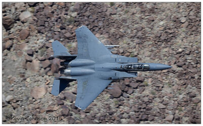
The Jedi Transition starts just west of Owens Lake at 36.403047,-118.01239. From here aircraft hug the desert floor and pull up just before the canyon to clear higher levels. From there they enter the Canyon at Father Crowley Point, and continue through the Valley and exit the valley 3 miles from Father Crowley point.

Tunisia

Tunis, Sfax, El Jem and Matmata

Duration: 8 days, 7 nights
Location: Tunis, Tunisia
Budget: €1500
Miles Travelled: 1,200

Departed Ireland for Tunis via London on the first day. Tour around the Medina – old town – followed by a visit to Carthage in the afternoon. Next we head to Monastir – Life of Brian – and the moloseum of Bour ge habib. On to Sousse and then Kairouan.

Highlights today was El Jem followed by Sfax. On the road then to Matmata to see the troglodyte homes. Next day we saw Lars homestead from the Star Wars movie – Hotel Sidi Idriss – and then on to Tozeur. After Tozeur we head to Moss Eisly or Tatouine from the Star Wars movies. Then it was on the road to Nafta and around 10km outside there is Lukes hut from the Star Wars movies.

The last section sees us take in Chebiki, Gafsa and back to Kairouan . Dougga settlement is the last big stop before heading back to Tunis for the night and heading home again.

Trip Itinerary

Please click on the sections below to look over a brief report of where to went each day and the stops involved. Be sure to check out the gallery for the images for each part of the trip.

Lukes Hut

Luke’s Hut

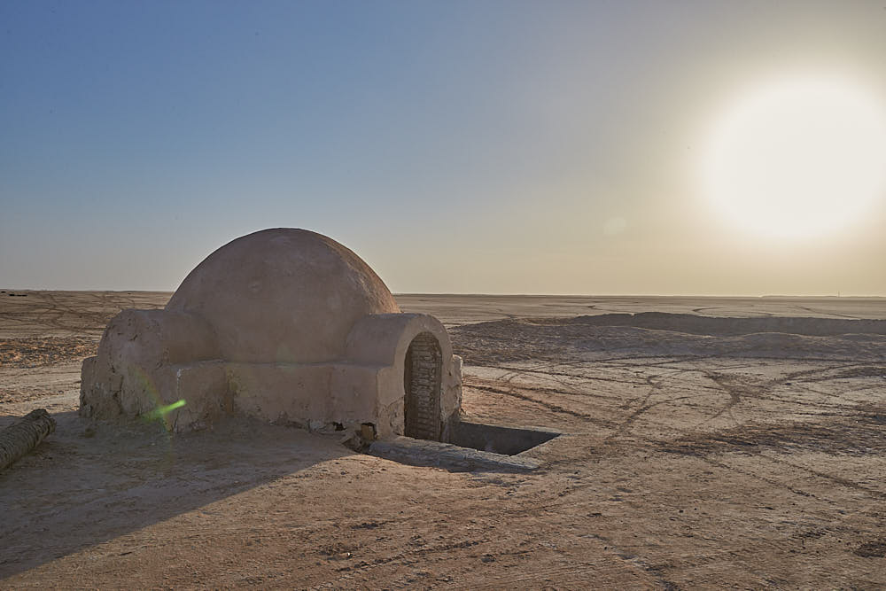
Located just outside the town of Naftah (Nefta) in the Eastern part of the country, the small dome represents the entrance to a below-ground-level home.

First constructed in 1976 when the film crew for Star Wars: Episode IV — A New Hope arrived in Tunisia, after serving its purpose Lars Homestead was left to decay in the middle of the desert.

Salt Flats

Salt Flats

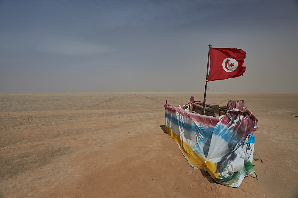
Chott el Djerid (also known as Chott El-Jerid, and several other variations of spelling) is a great salt lake located in the Tunisian part of the Sahara desert. It’s known to be the largest salt lake in the Sahara, and depending on your sources, it’s also the largest salt lake on the African continent. With a surface area of more than 2,700 square miles, Chott el Djerid is over 1.5 times larger than the Great Salt Lake of Utah.


Chebiki

Chebiki

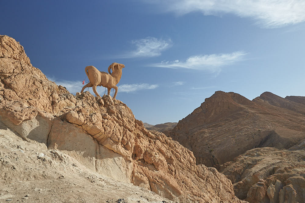
Chebika (الشبيكة) is a mountain oasis in western Tunisia, in Tozeur Governorate.

Chebika lies at the foot of the mountains of the Djebel el Negueb and, because of its exposure to the sun, it is known as قصر الشمس Qasr el-Shams (“Palace of the Sun” in Arabic).

In antiquity it was a Roman outpost known as Ad Speculum and later a mountain refuge of the Berber people.


Dougga

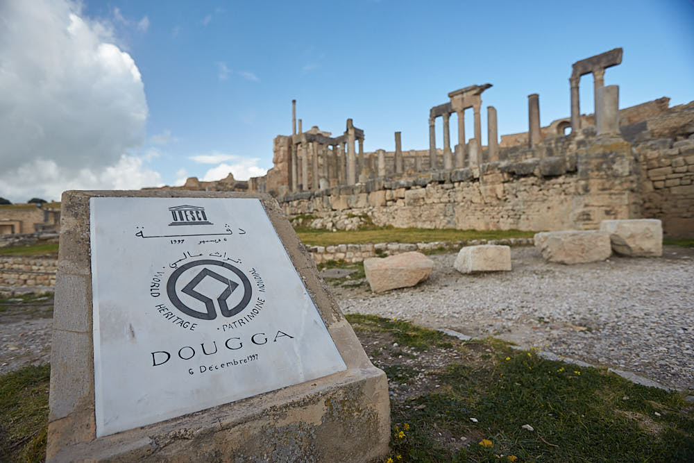
Before the Roman annexation of Numidia, the town of Thugga, built on an elevated site overlooking a fertile plain, was the capital of an important Libyco-Punic state. It flourished under Roman and Byzantine rule, but declined in the Islamic period. The impressive ruins that are visible today give some idea of the resources of a small Roman town on the fringes of the empire.

El Jem

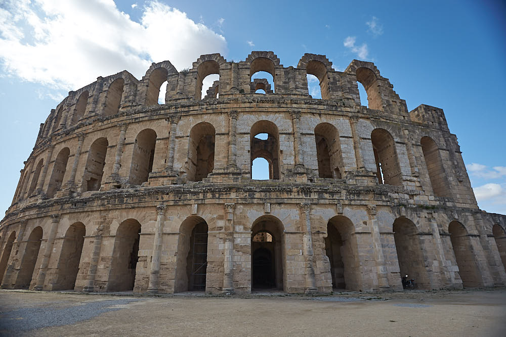
The impressive ruins of the largest colosseum in North Africa, a huge amphitheatre which could hold up to 35,000 spectators, are found in the small village of El Jem. This 3rd-century monument illustrates the grandeur and extent of Imperial Rome.

Kairouan

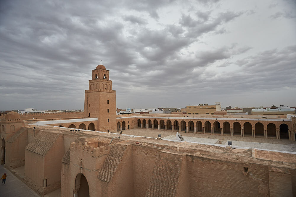
Founded in 670, Kairouan flourished under the Aghlabid dynasty in the 9th century. Despite the transfer of the political capital to Tunis in the 12th century, Kairouan remained the Maghreb’s principal holy city. Its rich architectural heritage includes the Great Mosque, with its marble and porphyry columns, and the 9th-century Mosque of the Three Gates.

Trip Itinerary

Please click on the sections below to look over a brief report of where to went each day and the stops involved. Be sure to check out the gallery for the images for each part of the trip.

Saturday 29th February - Day 01

So this trip came about because the Tokyo marathon and Japan excursion was cancelled due to the Covid-19 or Corona Virus pandemic. We got notice approximately two weeks before we were due to travel that the marathon was cancelled so we set about looking planning an alternative destination – and that destination was Tunisia.

I got up at 04:00 and left home around 05:00 and collect Mike and Pa is Abbeyleix and we were back on the road for 06:30. We got to the car park for 07:30 and dropped off the car. Then we headed to Terminal 2 for our Aer Lingus flight to London at 09:50. Checkin was fine and the security was quick and easy. We met Derek and got some breakfast. Then boarded and headed off to London to meet up with Masai McNulty and grab an onward flight to Tunisia with Tunis Air at 17:00. The cost of the flights was around 500 euro total – with a checked bag on each leg. 90 minutes flight time to London and 3 hours to Tunis- Carthage International Airport with Tunis Air.
Arrived at the airport, got through security ok and without any delays and transferred to the hotel in around 20 minutes. Grabbed some food and went to bed.

Sunday 1st March - Day 02

Up at 08:00 and got some breakfast – plain affair of eggs and bread, tea and coffee. We met out guide at 09:00 and headed to the Bardo museum and looked at all the different mosaics here from all over Tunisia. Then we walked through the old town – Medina – at the shops and stalls before exiting at another gate. Then we headed to the coast for some lunch before heading out towards Carthage and the ancient ruins here. We spent some time walking around the area and then headed back to Tunis for dinner and bed.

Monday 2nd March - Day 03

We got up, packed up and checked out of the hotel . Then we were on the road towards the coast towards Monastir- Life of Brian was shot here – as well as the moloseum of Bour ge habib- president that changed everything for Tunisia back in the 1960s. Then we got some lunch and headed onto Sousse. From here we changed some money and then we drove over to Kairouan- 4th holy city in the world. It started to rain once we got into the hotel. We checked in after a short walking tour around the city. Dinner and bed. Stayed in the Kasbah hotel tonight.

Tuesday 3rd March - Day 04

Today we headed to El Jem – roman structure. We looked around the area in the morning and did a short walking tour in and around the ruins. Then we headed Sfax for an hour – money capital of Tunisia . Short walking tour here and then we were on the road to Matmata – to see the homestead of the troglodytes- houses built into the rock/caves. We stayed in a troglodyte hotel here tonight and got some local Tunisian cuisine for dinner – soup, brik and then chicken cooked in rosemary herb and thyme/sage.

Wednesday 4th March - Day 05

Got up and headed to Lars homestead – hotel Sidi Idriss. Sidi means saint. It was only 5 minutes down the road from where we stayed the night before. Looked around and checked in online before heading on towards Tozeur. We headed off down the road to the Salt Flats – 90km long – on the way in to Tozeur. We got into there around 14:30 and got collected by a 4×4 and headed out to Camel Mountain – location in the desert where the English Patient was filmed.

We stopped here for a pano view and then we were on the way again mobbing the sand dunes on the way to Moss Eisly- Tatouine in the Star Wars movies. We looked around the set here and then headed out of Nafta and on the Lukes hut from the movies. The original was destroyed over the years but a petition was launched online that raised 10,000$ to restore the homestead and in 2011 it was rebuilt. We stopped here and got some photos – it is around 10km outside of Nafta. We headed back to our hotel in Tozeur – had dinner and walked back to the hotel and went to sleep.

Thursday 5th March - Day 06

Up and had breakfast and then headed to Chebiki. Did a short tour around the mountain loops and came back through the oasis. Then we went to a pano view point overlooking the vista and the Algerian border – only 20km away. We then headed to Gafsa for some lunch and then we got some ice cream and headed North to Kairouan for another nights sleep.

Friday 7th March - Day 08

Up for some breakfast and then we checked out of the hotel . On today to see the 160 acre area that is the ancient Roman settlement of Dougga. We did a walk around the ruins – saw the temple of Jupiter and other gods and explored the amphitheatre before departing. Place was very quiet. Then we headed to get some lunch before heading back to Tunis. We got in there around 16:00. We got some water at the shopping centre before it closed, got some dinner and watched a movie and went to bed.

Saturday 8th March - Day 09

 Today was the last day. We chilled out around the hotel and repacked the bags. Then headed to the airport at 11:00. Took around 20 minutes. Check in was easy enough and we got some food and spent the rest of our Dinar. Once you go through the security checkin they only accept euro and dollars. We ate outside and then headed in.

Flight was delayed from taking off by nearly 2 hours. Got to London around 17:05 local time – made up some time in the air. Got the bags and went to get the train back to T2. Train broke down on the track kept us in place for nearly 30 minutes. We decided to get a cab over to T2 and got there around 18:30. Checked in really quick – dropped the bags – and legged it through Security to get to our gate just as they were starting to board.Just about made it home that night.

Recent Travels

Be sure to check out our recent reports from the other trips that we have done around the world.

Jedi Transition – aka Rainbow Canyon 2015

Rainbow Canyon aka Jedi Transition

Duration: 7 days, 6 nights
Location: Lone Pine, CA
Budget:
Miles Travelled: 3,000+

Kevin and Paddy headed to LA for a day before driving a few hours North East towards a small town called Lone Pine. It was here that we were based for the week ahead to try to get some shots of low level flying (LLF) through the Rainbow Canyon - aka Jedi Transition.

The lookout point is around 45 minutes drive away from Lone Pine and it is pretty remote. Lone Pine offered the best accommodation, food and amenities based on the location.

Rainbow Canyon is part of the R2508 Special Use Airspace Complex, in Panamint Valley.  The Canyon is a part of the much larger Sidewinder Low Level route, and is officially called “Jedi Transition”.  Rainbow Canyon itself is also known as Star Wars Canyon. It is said that some movie scenes of the Star Wars movies were shot here.

The Jedi Transition starts just west of Owens Lake at 36.403047,-118.01239. From here aircraft hug the desert floor and pull up just before the canyon to clear higher levels. From there they enter the Canyon at Father Crowley Point, and continue through the Valley and exit the valley 3 miles from Father Crowley point. Most aircraft call up at 315.9 Mhz before entering (only pilot to pilot communication). The direction of flight is published as east-west but we have seen aircraft going the other way. Thanks to Ron for the information.
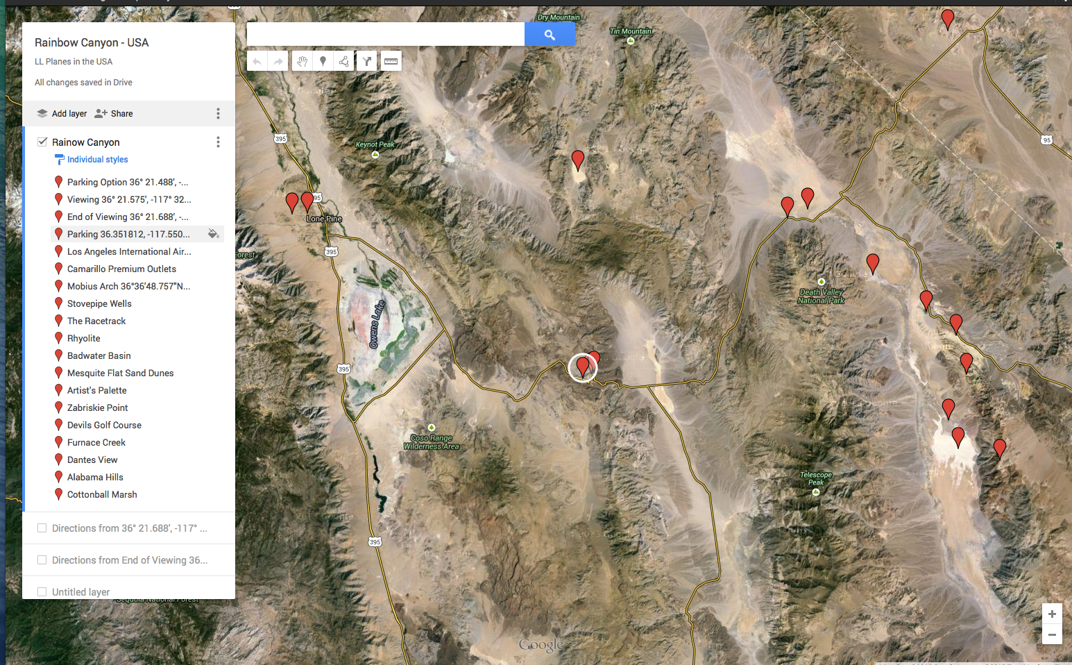
I put most of the information that I could find in the area on a Google Map – image shared below.

Map locations

The circled point in the center of the map is Father Crowley Point and car park. On the far left of the map , above the triangle and Owens Lake, is Lone Pine and the Comfort Inn where we stayed. Really nice accommodation, close to the turn you need to take in order to travel to the lookout and parking and about 1.5 miles outside of town. Breakfast was included and free wifi, parking and the usual other pieces. We headed into town each night and went to the local supermarket, Josephs, and got supplies for the following day. The supermarket was usually open till 20:00 each night so we were back from the hills by then.

A typical day ran something like this : get up at 07:00 and get some breakfast, then pack the bag and be in the car and moving by 08:00. The drive across was approx 49 miles from when you turn onto the road. There are mile markers on the side of the road as you are driving and Father Crowley Point is at mile marker 47 – give or take. You keep driving past this to mile marker 49.5 and on the right hand side – just after it – there is as pull out area where we parked the car. The walk to to hilltop takes about 10-15 minutes and then you are in place for the day. It takes about an hour to get from the hotel to the hilltop as traffic is usually light. We had an F/A-18 Hornet pass us the first evening as we were coming home around 18:00 hours and again another morning as we were heading out around 08:40 so traffic is definitely not restricted to 9-5 in the Canyon.

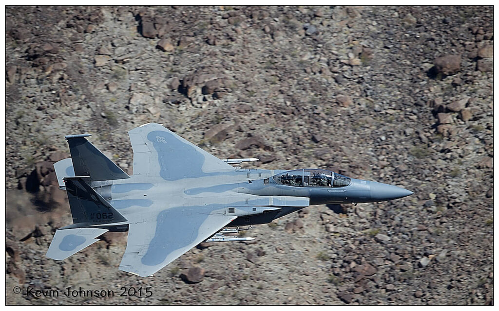
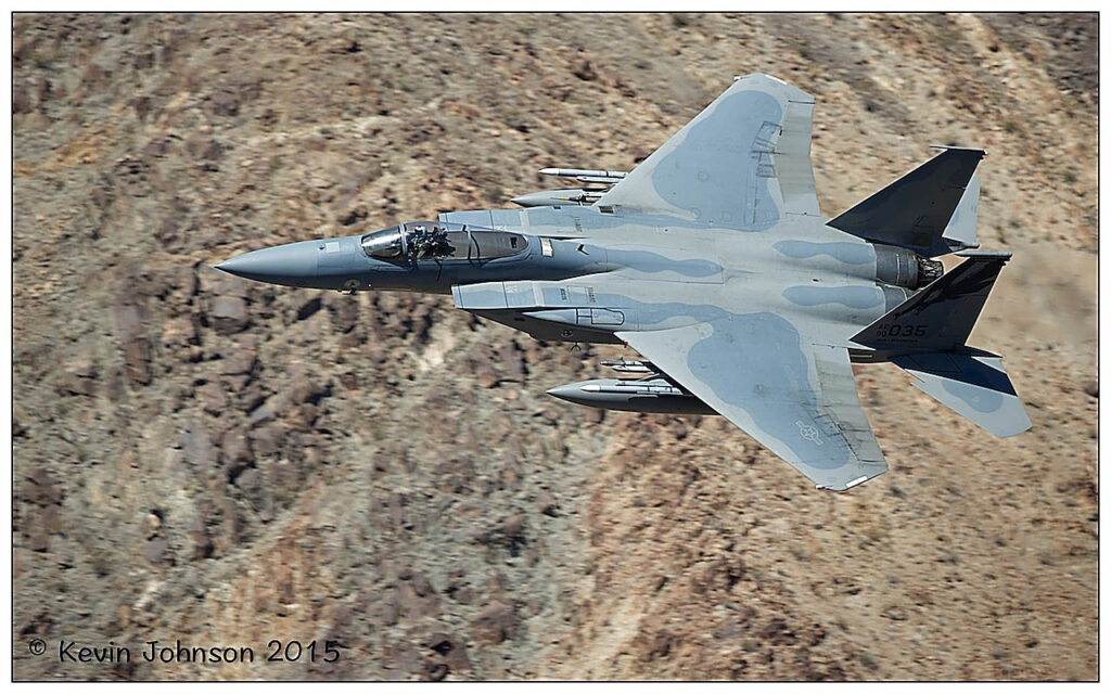
On Monday, we were caught napping with a pass from an F-15E Strike Eagle westbound at around 10:00. It being our first day, and not having a scanner, we just waited. The Eagle flew through and I did not get any shots of the first pass but he saw us and exited the Canyon beyond Father Crowley Point and came back through for us – East bound. This time we were ready …

West Bound

East bound

Early morning and later in the afternoon are probably the best times of the day to shoot but one cant be picky when you travel from Ireland to this great location. All in all we had 7 passes on Monday, 8 on Tuesday, 9 on Wednesday and 6 on Thursday. It was spring break and Easter Week so that might have cut back on the amount of flying in and around the area – I don’t know – but I was grateful for all the passes that went through.

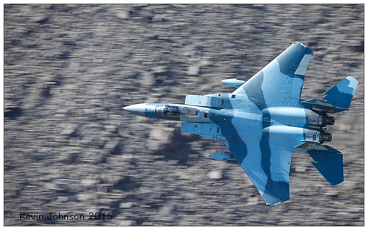
Early afternoon and this camo F-15C came through and I had the shutter speed down a tad too low for the capture. The image is here for show more than anything else …

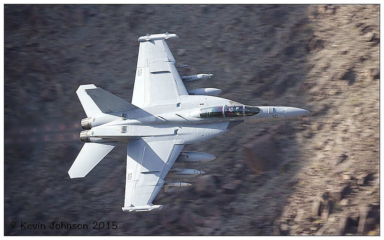
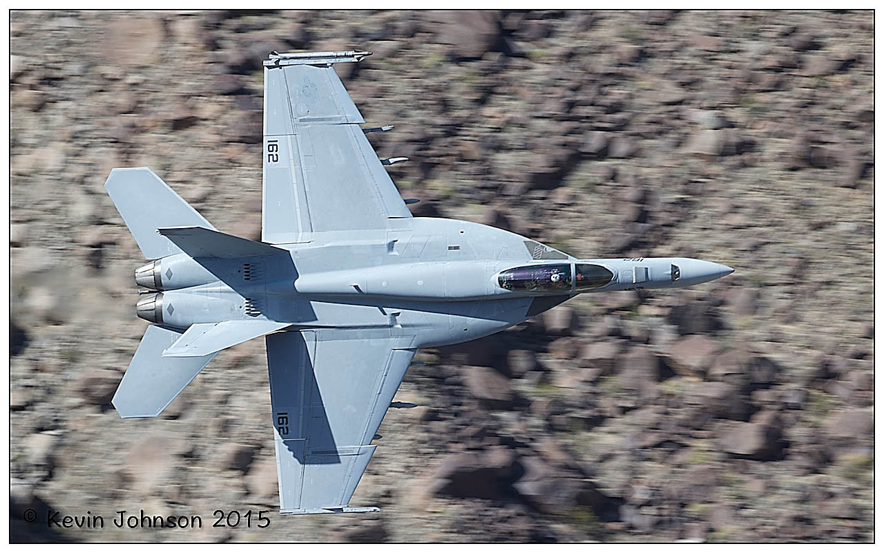
We had several F/A-18 Super Hornets and I think some Hornets or Legacy Hornets also when we were there …

F/A 18F Growler VX-9 "Vampire" burning through the Canyon

The Growler is an electronic attack aircraft. It is capable of disrupting, deceiving or denying a broad range of military electronic systems, including radars and communications.

F/A-18E Knife Edge through the Canyon

The EA-18E Growler is an electronic attack aircraft. It is capable of disrupting, deceiving or denying a broad range of military electronic systems, including radars and communications.

Canyon Floor View

A view of the hornet as it sweeps the deck and heads away across the canyon floor before pulling out as it reaches the wall – approximately 3 miles from the view point.

We had a special visit from an X53 NASA modified F/A-18 on the last morning also – the pass was high but I included the images here for show more than anything else. A C17 came over the hill to the right of Father Crowley Point also and dropped down into the Valley – impressive and huge…


They can be seen in the Photo Gallery for the trip along with some other nice shots from the excursion.

Recent Travels

Below is a collection of the most recent articles , galleries and blogs on the site – feel free to look through them and let us know what you think!

Pre Antarctica – Argentina

So in early December 2013, myself and my brother headed to Antarctica to reach the 7th continent – and discover what it had to offer. Packing was a bit of a chore for this trip but I finally decided to take the following gear. Once we get into Buenos Aires, we spent a day here looking around and sight seeing before flying on to Ushuaia. We had already visited Buenos Aires in 2008 with the lads so we were kinda familiar with the place and area. We stayed at NH9 de Julio in the City Center. Nice hotel, clean, centrally located and within walking distance of several of the main attractions. We did a sight seeing tour with the hop-on hop-off local bus tour company and walked around the city to get some air and see it for ourselves. The following morning, we had an early flight from the national airport to Ushuaia. People were coming out of the nightclub at 05:00 when we were en-route to the airport – it only took us about 20 minutes to get from the city center to the airport. We checked in, dropped off the bags without any problems even though we were over the weight limit and settled in to wait for the onward flight. Three and a half hours later and we were touching down in Ushuaia and getting transferred to our hotel – Del Bosque Apartment Hotel. Once we had checked in we went out for a walk to get our bearings and look around the city – small enough but tidy. We had our first trip later on that evening to go looking for Beavers.

We were collected at 18:00 to head out to the park where the Beavers are located. The tour company – Comapa Tourism – had the driver and guide collect us at the hotel and we drove for around 30-40 minutes to the site entrance. Details on the website are as follows:

BEAVER WATCHING
Total duration: 4 hours.

Hiking: 1 Hour.

Includes: transportation / hiking / meal.

Equipment: rubber boots and raincoat.

Minimum: 2 pax.

Departure from the hotel towards the valley. Arrival at the refuge located in a privileged place with a panoramic view. After putting on our rubber boots we start hiking. The area is the ideal habitat for those lovable creatures and by crossing several dams we will have the opportunity to watch some of these wild beavers. Hot drinks will be provided.

Later we will return to the shelter where we have the option of either having a meal. Return to Ushuaia.

We got back to the hotel at 22:00 that night and were happy as we had some beaver images as well as upland geese and a meal – a good start to the trip.

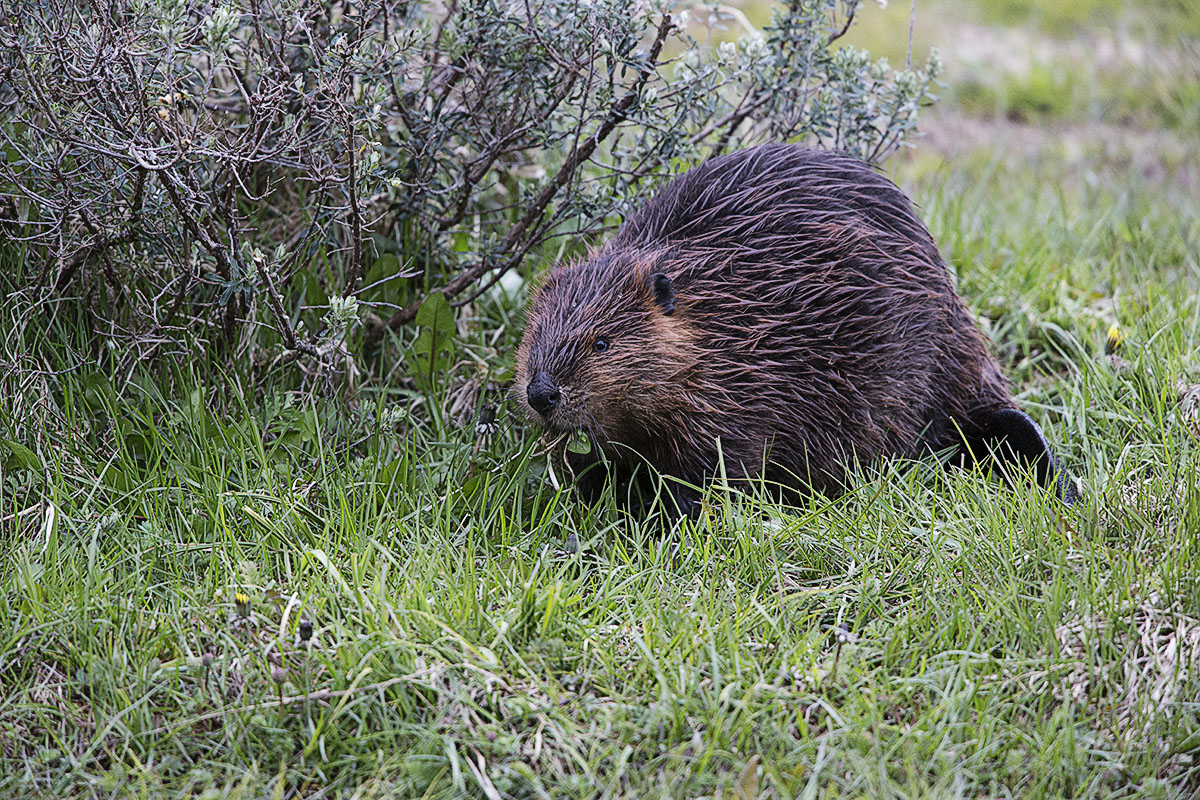
Beaver on the grass

Beaver in Argentina near the water – grazing on some scrub

Beaver in the water

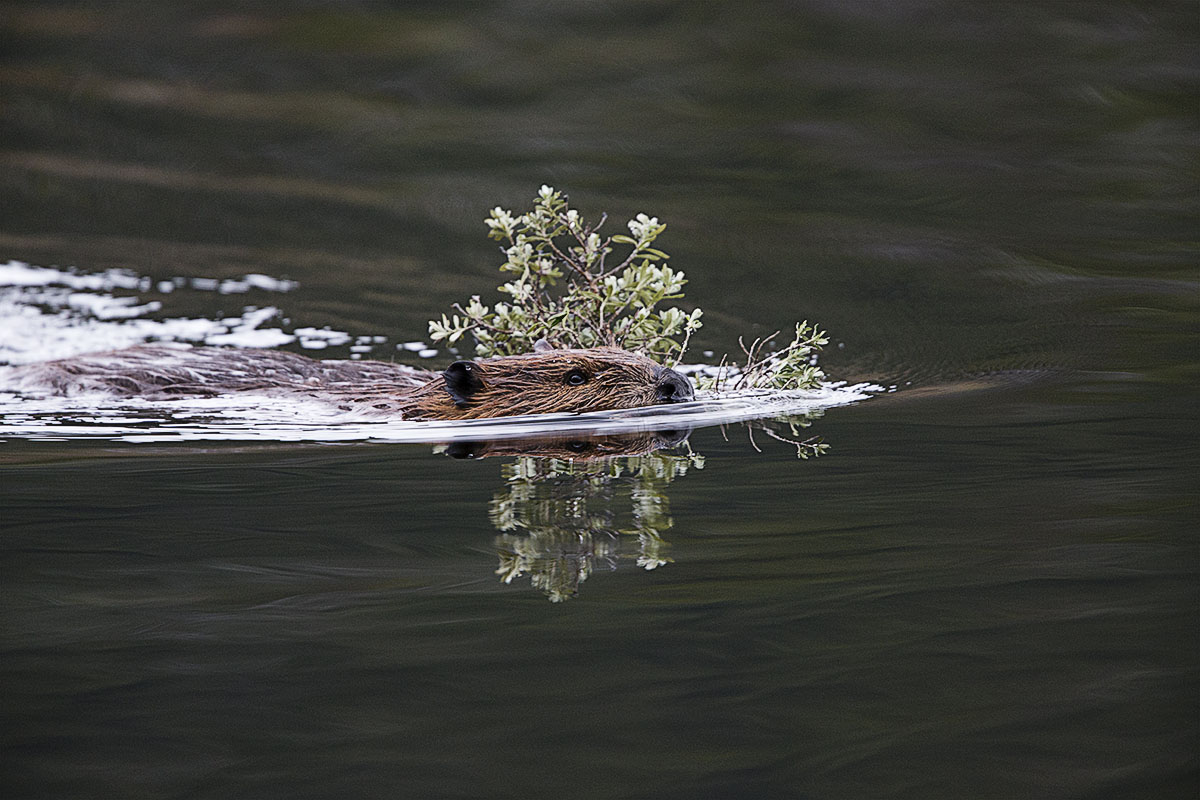
Beaver in the water taking some food back to its holt to store for the winter.

Reflections

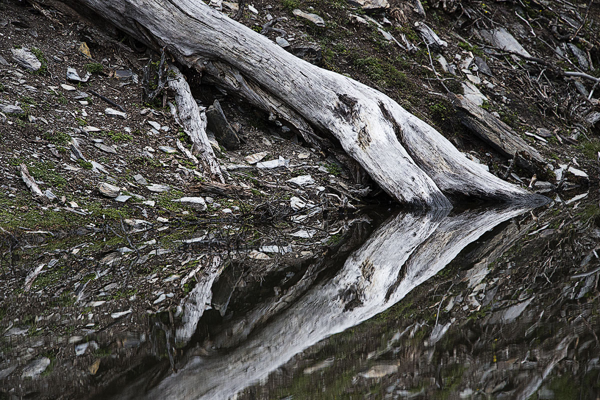
A nice reflection from the surrounding area when we were on the lookout for Beavers

The following day we headed into Tierra Del Fuego for a 1/2 day train journey to “Fin del Mundo” or the end of the world. We hired a local company to bus us out to the train – purchase the train tickets for us and then collect us on the other side. I think that the train ride is approx 40-45 minutes long and it is only ok – you do not really see a lot of cool stuff and you are just on the edge of the National Park – you have to go a lot deeper into it to see the really good stuff. But if you have 1/2 day to spare it is worth doing I think. More details can be found here.

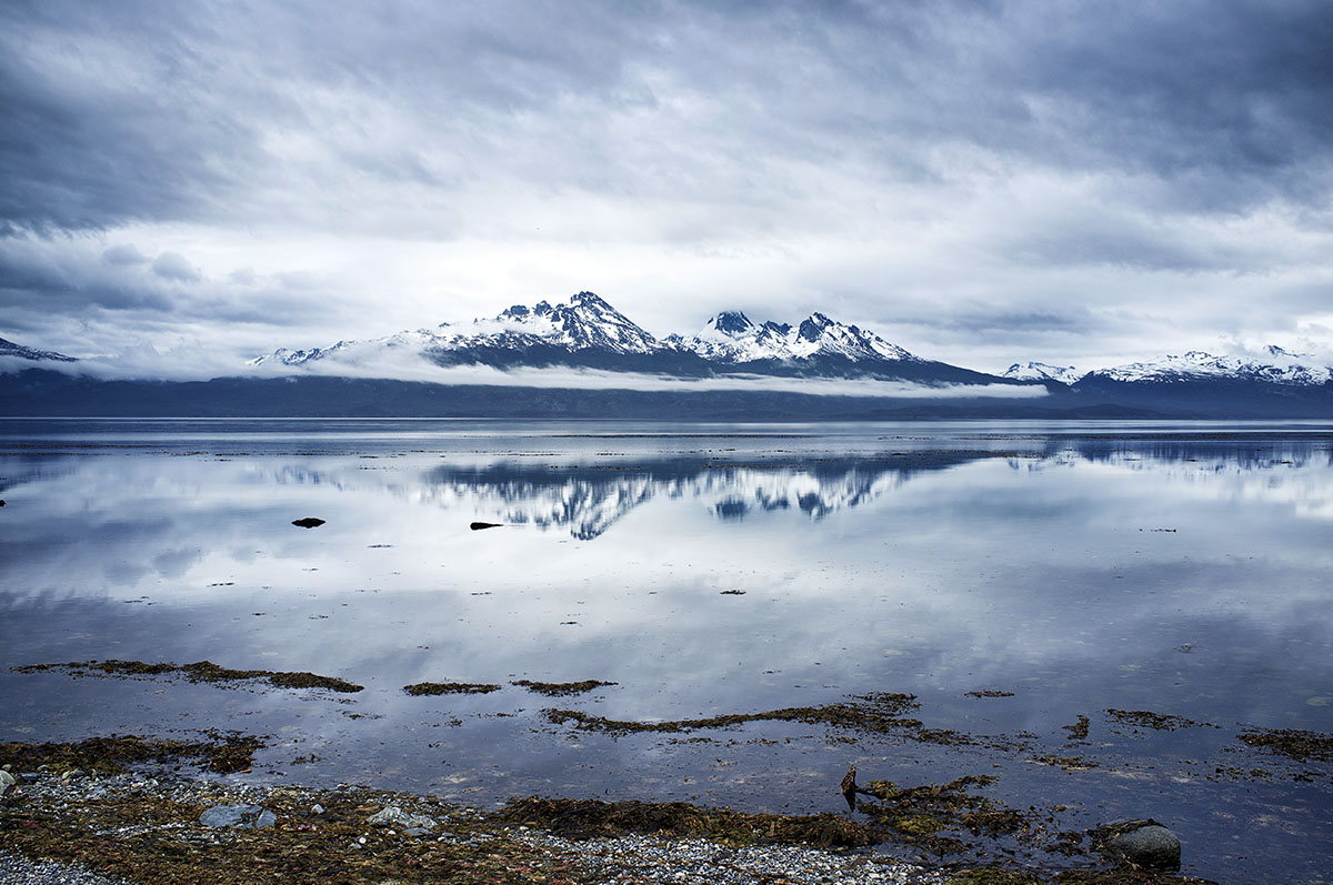
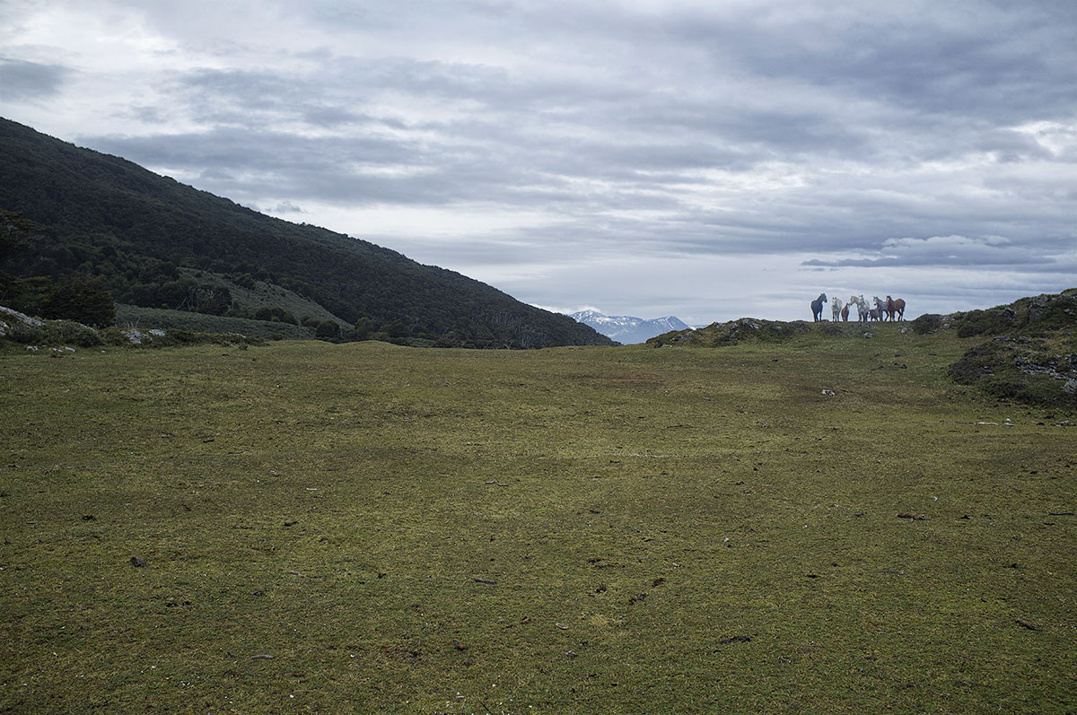
The following morning we did what we probably the best trip of the journey to date – 4 hour horse riding tour in and along the boundary of the National Park. We were collected at the hotel and taken to the ranch – 20-30 minutes drive away. We got saddled up and headed out for the excursion. Definitely bring wet pants with you as even if it is not raining you will be going through scrub and trees and brush for the journey and you are going to get wet. We had some rain but for the most part it was really enjoyable and really really peaceful. We stopped after two hours and had some tea and sandwiches and just relaxed and enjoyed  the scenery, vistas and the peace. We headed back to Ushuaia and relaxed for the afternoon.

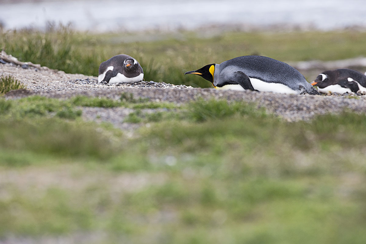
The following morning we headed for Harberton ranch via the road network where we got our first introduction to the different penguin colonies in the area. Only a set number of people can visit the ranch per day, and in doing so, take a boat out to the penguins on the island and walk amongst them. This is truly rare and something that I would recommend. A lot of tours out of Ushuaia will operate down to the area but cannot land on the islands. Harberton ranch itself is the only one that will allow you to walk amongst them – for a price!

We arrived back into Ushuaia and headed back to the hotel as we were checking out tonight and heading to the Los Nires hotel where we were going to stay before embarkation tomorrow at 16:00. The following morning, we relaxed and did some sight seeing near our new locations before heading into town to get on with our journey to the White Magnet.

Recent Travels

Be sure to check out our recent reports from the other trips that we have done around the world.

Morocco, Casablance and the Sahara

Morocco, Casablance and the Sahara

Duration: 10 days, 9 nights Location: Morocco, Africa Budget: $1750 Miles Travelled: 1970KMDays: 10Dates: 22nd March 2018 to 31 March 2018Tour Company: Morocco Round TripsCurrency: Dirham (10.7:1 exchange rate)Time Zone Difference : NoneMorocco Driving Distance :...

Tunisia

Tunisia

So this trip came about because the Tokyo marathon and Japan excursion was cancelled due to the Covid-19 or Corona Virus pandemic. We got notice approximately two weeks before we were due to travel that the marathon was cancelled so we set about looking planning an alternative destination – and that destination was Tunisia.

Jedi Transition – aka Rainbow Canyon 2015

Jedi Transition – aka Rainbow Canyon 2015

The Jedi Transition starts just west of Owens Lake at 36.403047,-118.01239. From here aircraft hug the desert floor and pull up just before the canyon to clear higher levels. From there they enter the Canyon at Father Crowley Point, and continue through the Valley and exit the valley 3 miles from Father Crowley point.
Antarctica – Photo Gear

So if you are lucky enough to be going to Antarctica then all I can say is “Well done” as I know that it is a place that few people will get to travel to in their lifetime. It is an expensive excursion and one that few people will attempt to take on. In fairness, there are easier ways to spend 10-15K USD right.

But enough of that – you are here because you are thinking “How much camera gear do I take with me” or “What camera gear do I take with me” on this Epic Trip 😉

Well I was lucky enough to get out here in December 2013 with my brother and all I can say it that we were really blessed with weather, travel locations and ship routes etc. I will fill you in on what I took on the trip and will hopefully write another article on the actual trip itself in due course.

So I am going to make a few assumptions here before going any further – namely that you are a Semi-Pro or Professional photographer or a budding up and coming photographer with a lot of gear and cant decide on what to take.

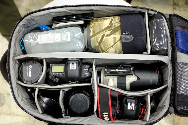
I found another article online this morning that relates to the bag that I took – a Guru Gear 32L bag. There is more information here on the bag and what is included in it. Nice light reading.

PDF Document on Equipment and Gear

 I created a document that I spliced together from several different sources on the Internet and books on what gear to bring. I was also fortunate enough to have some friends that headed out there in January 2013 – a main reason that we headed out there in December actually.

So what did I bring and what did I leave behind and what did I regret taking/not taking on the trip.

Camera Bodies

  • Canon 1D-X
  • Canon 1D Mark IV
  • Fuji Finepix X100
  • Go Pro Hero 3+

Lenses:

  • Canon 500mm f4 IS USM Mark I
  • Canon 70-200 f2.8 IS USM Mark II
  • Canon 24-70 f2.8 Mark I
  • Canon 16-35 f2.8 Mark II

Accessories:

  • Battery Chargers ( 1D-X/Mark IV, Fuji Finepix & GoPro)
  • Power Cables and adapters
  • Spare batteries
  • Memory Cards
  • External Hard drives x2
  • CIR Polarising filters (77mm)
  • Card Reader
  • Lee Filters – ND Grad
  • 10 Stop BnW Filter
  • Tripod
  • Monopod
  • Wimberly Gimbal Head (for 500mm)
  • Rain Covers for 500mm and 70-200mm lenses
  • and other bits and pieces


The majority of this gear went into the Guru Gear bag – as seen above. It all packed away nice and neatly and there was no problem anytime getting the bag into any of the overhead storage units on any of the flights. Weight wise it was probably coming in around 14-15kg in weight but I took a chance and hoped that it was not going to be weighed. If I had to pay at the airport I was willing to do that – safer than checking it in.

I did have another small padded day bag that I used when in the cities and walking around the place for sightseeing in Buenos Aires and Ushuaia. I put some of the cables and battery chargers in here and checked those in as they were safe enough and I would be ok if they did not make it down for a few days.

So here are some questions that I think might be of interest to people that are traveling and hopefully the answers will help you decide on what to bring and what to leave behind. Again this is just my opinion and what worked for me at the end of the day – it is not necessarily the best or worst idea out there – it is just an opinion.

Q: Do you really need a tripod? 
A: I think that a light one is useful. There was two of us and we shared the use of it between us. On the boat I got a bit more use out of it that I thought. I used it a lot with the GoPro to just shoot timelapse or footage from different angles and aspects of the boat. We also camped so we got to use it then and also in Ushuaia. Dont bring a big heavy tripod – take some travel worthy and light and it should come in handy.

Q: Did you use the rain covers ? 
A: I did use them at the start a lot – just being cautious. We were really lucky with the weather. I took off the covers after a day or two as I did not need them any more. I also had a neoprene cover for the camera body but never used it. It is a good idea but the battery life is really good in the 1D models so I did not need it. It also makes adjusting settings a lot more awkward and if there is a humpback whale or leopard seal or penguin active near you – the last thing you want it try to change aperture or ISO setting through a cover and protective layer and then with gloves on. Pack them – have them there just in case but use sparingly. If the weather is nice then you are good. If there is snow out then take it with you.

Q: How many memory cards did you take with you?
A: Me personally I think I had nearly 200GB of memory cards, 4x32GB, 4x16GB and some 8GB SD cards and several 4GB cards. All worked fine for me for the trip and I probably shot close to 130GB of images or 5100 odd images in the space of the two weeks that we were away. We had a laptop with us, so we backed up the cards each evening to our external HD’s and left the cards with the images also so we had a secondary backup just in case. Then on the last day we copied all the folders to the other persons HD so there was a third backup – just in case. All worked out nicely now thankfully.

Q:Do you really need a laptop?
A: I personally think it is a good idea. First you can use it to backup your images when you want. I know there are computers on the boat but they are in use a lot of time so access can be restricted. It is nice to be able to backup your data when you want. It is also a good idea to have some TV Shows or Movies with you to look at in case you need to pass the time on the Drake Passage or something – you might be under the weather and need something to take your mind off things.

Q:Did you use a CIR Polariser a lot ? 
A: Once we got down to continental Antarctica itself I did put it on the 70-200 and the 24-70 and used it for shots of the ice, water reflection and landscape shots. I think that it is no real weight to carry and it does come in handy when you are down there so take it and use it .

Aurora Borealis Hunting

The Land of Ice and Fire - Aurora Hunters

Duration: 8 days, 7 nights
Location: Iceland
Budget: €1500
Kilometers Travelled: 3300

A short week to head over to Iceland and do some sight seeing and look for the Aurora Borealias – or Northern Lights as they are better known as.

The weather is January is not the best but the plus side is that accommodation is cheap and if you get lucky, you can have an amazing time in Iceland.


Day 1 – So it was an early start… something that is akin to all Epic Trips at one point or another. I could not really sleep anyways so I got up at 03:30 instead of 04:00. I got some something to eat and then finished packing my bag and headed into Limerick to collect Paddy at 05:00. He was finishing his lunch for later in the day and then we were out of there. We drove through Limerick and made it out to Shannon for just after 05:30 and parked up. The weather was fine and there was not a lot of cold in the air – it was showing 10 degrees C on the car on the way out. We dropped off our bags at the Aer Lingus desks and then headed up through security. Here was something strange – in order to get through security we had to take everything out of our camera bags – I have never seen the likes of it before. Luckily we were in no rush but it was really wierd to be asked to remove all the cameras and lenses. Anyways, we got through security and then we headed to the waiting area for flight EI380 to London Heathrow at 07:30. It was only 06:00 when we got there so we relaxed for a bit and chatted and got something to eat. We headed down to gate 06 at 06:45 and got a seat and waited for them to call us by row number. We were in row 10 so we were near the end before we got called. We got onto the plane and got our gear up into the overhead bins and settled down for a snooze on the way across to London. The crossing was nice and short with a bit of a delay around London due to congestion. We had to circle for around 10 minutes. We slept for 40 odd minutes and were on the ground around 08:50 then in Heathrow.
We grabbed our gear and headed into the terminal – we had to collect our bags and check them again at the Iceland Air desk when we were going through. There was no one at the desk when we got there so we got some breakfast – round two – and then the desk was open shortly after 10:00. We dropped off the big bags ok and then had to weigh in the carry on items. This was the first time that I actually had to weigh in the gear before going on the plane and when you have cameras and lenses your bag tends to be a bit heavier than the standard bag. Mine was coming in at around 16kg seemingly but the nice lady on the desk let it go this time – but it was a concern. The flight was not full so we were ok today but I would have hated to see what would have happened if the flight was full and they wanted me to check something. Anyways we headed through security – not having to take anything out of the bags this time apart from laptops etc – and then headed into the holding area. Pa bought a point and shoot camera in Dixons and charged up that for the trip and we waited around then till the flight information was updated on the screens. It was around 12:20 before they updated the information for us and told us to go to gate 5A for the onward flight. We refilled our water bottles at the water fountains near the toilets and then boarded the flight and headed to Reykjavik. Again I slept on the flight for 20 minutes and then got something to eat and watched some of the videos promoting the country and capital. The flight time was 2 hours and 35 minutes. We collected our bags and headed outside the airport and got the bus into town. Flybus was the operator and it took approximately 45 minutes to get to the train station. We grabbed our gear and walked the 1km to the accommodation for the night – Apartment K. We checked in and dropped our bags and got the gear and went out for a walk to get our bearings and get some air. We walked around the shopping street and up to the church Hallgrimskikrja – there were still some christmas lights on the streets also. We walked along the main shopping street – Laugavegur – and then down by the harbour before heading back to the apartment and getting something to eat and watching some tv and going to bed. It was pretty cloudy now tonight so there was not much point in us trying for some Northern Lights viewing – plus we did not have a car. It was dark from around 17:00 and would remain that way till 10:00 the following morning

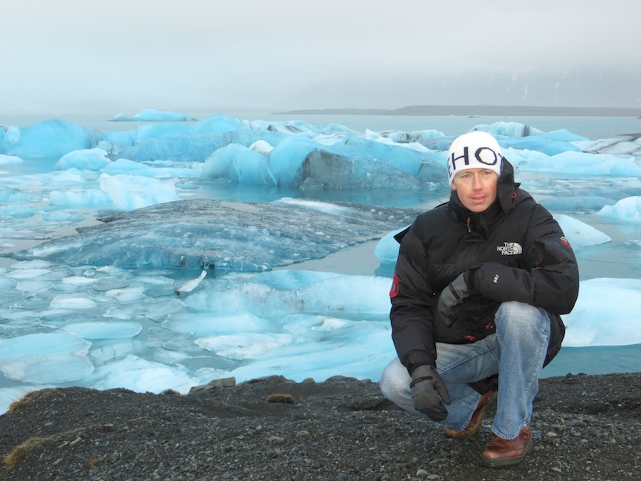
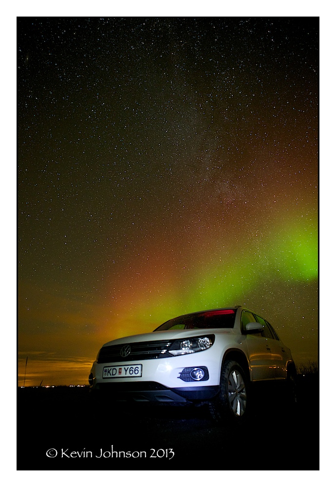
Day 2 – So we got up after a good nights sleep – the apartment was nice and we got up and grabbed a shower before heading out to a local supermarket and grabbing a few bits and piece for breakfast. At 10:00 we were back at the apartment and cooking some breakfast. We finished up there at 11:00 and instead of getting a taxi to the car rental place – the original plan – we called them from the accommodation and asked them to come and get us. They said No Problem and were there a few minutes later. We headed over to Herzt and got our car at 11:30 and were on the road at 11:45 for the South Easy and Vik. We got a VW Tiguan – plate KD Y66. The jeep was well equipped now – Sat Nav, heated seats, full electrics, cruise control and only 1200km on the clock so new to boot. We headed out of Reykjavik and started driving through the rain and wind to our destination for the night – some 400 odd km from where we were. We drove through all sorts of weather from heavy rain downpours to clear days and nice light – the temperature never got into double digits though and went as low as 2.5 degrees C at some stages and we could clearly see snow and ice on the hills and mountains that we were driving through. We were on Highway 1 for the main part of this journey – first heading to Hella which is located about 90km away and across the inlet and on towards Vik – about 180km from Reykjavik. Hella is a much bigger place compared to Vik – where we stopped around 14:15 and got some food in the grocery store. We were back on the road then at 14:30 and heading towards Guesthouse Hali which was located about 12km on the far side of the Glacial Lagoon. We passed by some other glacier formations about 70km from the final destination – Skaftafell being the main one – but the weather was really bad so we said that we would stop on the return leg – and it was getting dark besides. The overall journey was 390km from where we collected the car that morning and we arrived at 17:15 in the evening – it was well and truly dark at that stage but we had arrived at Jokulsarlon safe and sound. This area is part of the Vatnajokull National Park. We checked into our room for the night – room 16 – and then cooked something in the kitchen area and watched some tv. The plan then was to chill out for a bit and get some sleep and head out around midnight down to the lagoon to see if there was any Northern Lights activity about the place. There is definitely a need for the heavy winter gear here as there is a biting icy wind that blows throughout the area that drops the perceived temperatures by a few degrees.
We cooked in the kitchen area in the house later on and then chilled out a bit before deciding to head out for some aurora hunting later. Pa slept for a bit as he was tired from the days driving and I watched Taken 2 on the ipad with the headphones in before waking Pa and heading out around 11 back to the Glacial Lagoon. It was very dark out but there was a low lying cloud and mist in the air as well so we were at nothing in heading down there really. There was nothing to see apart from a few street lights and the odd truck heading to some far off destination. We headed back to the guesthouse and went to bed around 01:00. There was no point in getting up again later in the night as we were not going to be able to see anything.

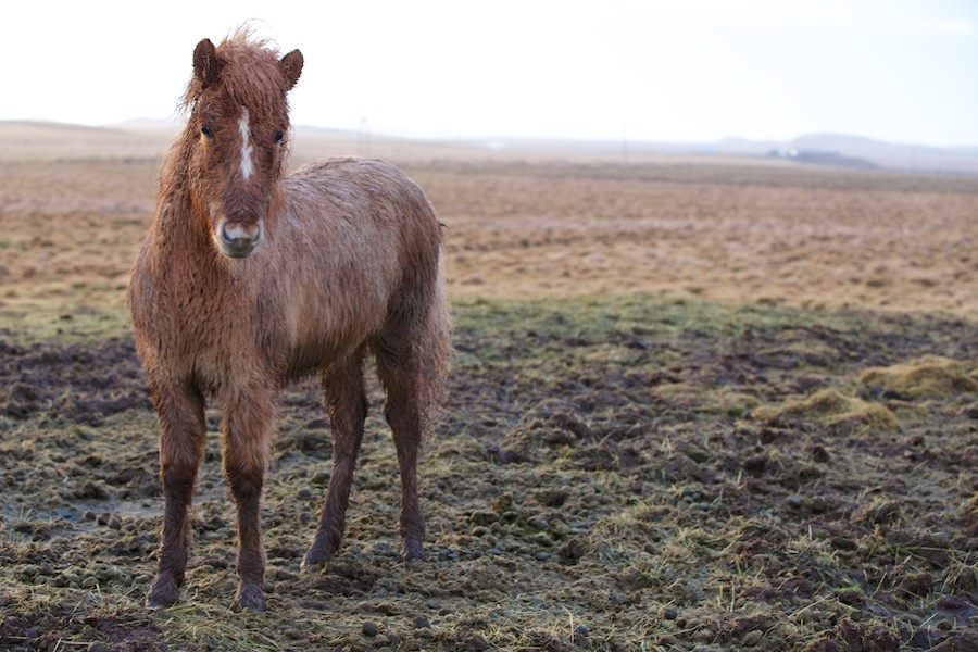
Icelandic Horse

Day 3 – We got up this morning at 08:30 and got some breakfast in the canteen. It cost about 5 euro extra on top of the lodging bill but it was worth it. We got a continental breakfast and then headed back to the room to get our gear ready. The morning was really dirty and wet and not at all appealing for heading out to take some landscape shots. We left the area at 10:30 and headed east towards Hofn. The roads were really quiet and there was not a lot of cars on the road at that hour of the morning – or later on for that matter. We came upon some caribou on the road alright as we came around a bend on the way to Hofn – and tried to get some pictures of them but the light was so bad it was next to impossible. I was pushing 2500 ISO on the Mark IV and I could not get a decent shot unless the caribou were stopped. I used the 1D X with the 70-200 and had to push a similar ISO in order to get 1/200 @ f2.8 for a shot. We continued on towards Hofn and arrived there later on in or around 12:30. It looked like a fishing town for the most part with some wading bird locations on the outskirts of town. We parked up and walked around the place and then got some diesel for the jeep – cost was 256.9 ISK per litre. We headed back towards Hali and the weather seemed to be picking up. There was some nice landscape shots tentatively appearing through the clouded areas at stages but nothing really emerged. We got back to the accommodation without incident around 13:45 and I headed out for a run at 14:00 with the sheepdog. We did 10 miles and he even had the energy to chase some cars in between. I got back to the room and grabbed a shower just after 15:00 and the sun was setting at 15:30 when we were getting a late lunch. It did not look like there was anyone else in the house with us for the night at this stage. We grabbed our gear and ran outside and got a few shots before the sun finally disappeared – it was the most sun we had seen since we got here on Tuesday. We headed back inside and I slept for an hour and got up around 18:00 and then started to look at getting some food. There was no one else in the place with us so we cooked something and watched some tv and chatted. We headed out around 21:00 and the weather was dry – we went back down towards the Glacial Lagoon – still having not seen it in daylight since we arrived. We arrived there but there was cloud and rain and nothing to see so we headed back in the Hofn direction. Unfortunately the rain was following us around the place tonight so we did not get anything useful this night either. It was back to the room and watched something on tv and went to bed around midnight.

Glacial Lagoon

Day 4 – So we got up around 08:00 this morning and grabbed a shower and headed up to get some breakfast. The place was really quiet and there was only one other couple in there before us. We got our food and headed back to the room to finish packing and get on the road. It was 10:00 when we checked out and headed back towards the Glacial Lagoon – the sun was starting to show through some breaks in the clouds so we were hopeful that we might see something nice this morning. We got up to the Lagoon and drove in but there was a heavy mist hanging over the mountains behind them. We drove back across the road to the beach, parked up and headed down to the waters edge. There was biting wind out but overall it was not too bad. We did get caught in one or two showers – where we headed back to the jeep to let them blow off – and then resume our photography. Once piece of gear that I forgot was my camera cover – when the rain came it got quite wet.I know that some cameras are weather sealed and the Canon 1D series are one of them but I still did not like leaving it out in the rain. We continued shooting and the wind broke up the clouds some more before we left the place so we got some nice images of the glaciers on the black beach before heading west back towards Reykjavik. The lagoon itself is impressive and we saw some chunks of ice floating out to sea from the channel but it would look a lot more impressive just before the start of spring or summer I think when the mist and could are not so prominent. We also saw a seal swimming up and down outside the lagoon outlet at one point. We packed up and hit the road at 12:00 and then headed for Skaftafell which was some 70km away from us. The roads were quiet and the weather was actually quite nice – compared to when we headed out this way a few days ago. We could actually see breaks in the clouds and blue skies and the sun on the tops of the mountain peaks covered in snow and ice. We stopped at the glaciers and took some more images before continuing on towards Vik – another 130km from us. We got there without incident – the only issue being that the sun was blinding us as we drove into it. The land and area through which we drove is really impressive and flat – stretching on for miles and miles. There are huge sections of black sand or ash and there was other sections where the land is covered with a soft covering of some sort of green moss type substance. We got down to Vik and posted some postcards and then headed onto Hella which was another 90km away. We got there just after 16:00 or sunset. We found the hotel and check it – the place was small and quiet where we were staying – so is the town. We bought some food in the local Supermarket and cooked that in the cabin – Number 14 – and then chilled out for a bit. It is a nice place for Northern Lights viewing but unfortunately the weather or the forecast for it were not set to be a high number tonight. We said that we would check anyways when we were going to bed and see if there is any activity in the night sky – the cabin is remote enough that the only light is from us and there was no one else staying in the area that we could see.
Approximately once an hour we would head out and have a look – the easiest way to test was to take an exposure and see if there is anything in the sky. It was not until 21:00 that we thought we saw something with the naked eye. There was a faint hint on the horizon behind Hella. We confirmed it with an exposure and then headed for the jeep and started driving. We headed out of town towards Vik on Road number 1 and about 2km out we turned off to the left and started to climb. It seemed perfect – a nice quiet road, gaining altitude and leaving the town and its light pollution behind. We stopped a few miles up this road and set up our gear and started to take some photos. They say that you need the three C’s when looking for the Northern Lights – Cold, Crisp and Clear or Cloudless – well tonight fit all those requirements. The sky was covered with stars, the roads were freezing and it was freezing when we left the cabin. We started testing shots and exposures and tried to get the best setting for the images – ranging from 15 sec to 30 sec exposures. Once we got our night vision it was amazing to see the Northern Lights low to the north of our position dancing across the sky. We moved up and down the road and across to another road and down to Hotel Ranga to see what the views were like. There was a low lying cloud over Hella and it was casting an orange glow over the sky – the Northern Lights moved across that way at one point so it was hard not to get it into the images. We headed back to the cabin around 00:30 when a bank of cloud had started to move it. All in all we were really happy and had gotten some nice clear images from earlier in the night. Time for bed.

Hella Aurora View

Day 5 – Today we got up to be greeted by cold and rain – the temperatures were hovering around 0 degrees C and the rain was falling as sleet or rain at time – a bit like Ireland for the way it was changing its mind – weather wise. We packed up the car and headed off towards Selfoss and the Golden Circle. Selfoss was about 30km from our position and we passed one or two cars that were off the road due to ice so we took it easy as we headed over towards our first point of interest – Skalholt church. We turned off road 1 and headed North on road 30 and turned left up there onto 31 and Skalholt church. We passed by some greenhouses on the way that were heating several large vegetation farms as well as some geothermal plants. We took some images at the church and headed on then to Reyholt and then on to Geysir. This is a geothermal area that is quite active and has several geysirs that are displayed all day long . The main attraction at this area is a geysir called Strokkur that – according to the information is active every 7-8 minutes. When we were there however it was more like 2-3 minutes and it was erupt. Pretty impressive. Just bring some rain gear for your camera etc. It is reported to shoot hot water into the air between 25 and 25 metres tall. Geysir is said to erupt and shoot streams of hot water 70-80m into the air however it did not erupt when we were there. We headed on from there another 10km down the road to Gulfoss and the waterfalls. We took some images here and then headed back towards Selfoss – approximately 71km away. From there we went back to the accommodation and got something to eat. The rain was back in on the way home and the temperature was dropping again . We got back and ate and then watched a show and checked the sky every hour or so. However tonight we saw nothing – back to cloud and no rain . We went to bed and checked the sky during the night when we woke – to find that it was snowing but still no clear skies.

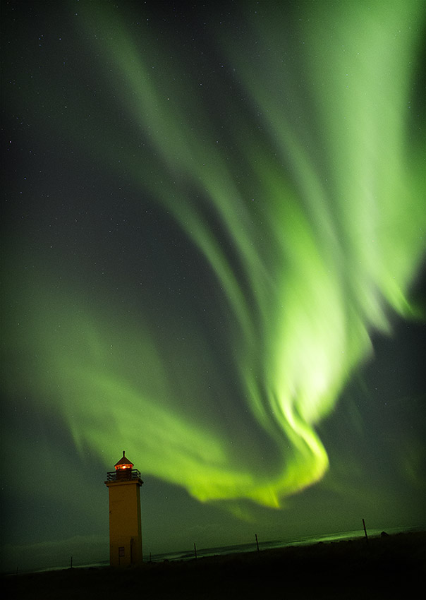
Day 6 – So a light fall of snow was on the ground and the place was white – everywhere. Looked really nice now and there was no real cold there – no wind chill effect in place. We packed up the car and headed down to check the internet for the forecast tonight and get on our way. There was no one in the restaurant so we left the key in the room and headed off around 10:30 in the hope that we might see a bit of sunrise somewhere along the road to Selfoss. Alas that was not meant to be – the roads were fine even though they were covered in snow and ice – there is a lot to be said for Winter Tyres over here. We took it handy on the drive up to Selfoss – about 30 minutes – and then turned off onto the 34 and down towards the coast – about 10km away. The roads were less travelled here but overall not too slick. We were on a scouting mission for tonight in the hopes that the sky would remain clear and we would get some Aurora activity. We headed south along the coast road and stopped off in a few places as potentials for later on – there was a definite increase in the wind chill due to being so close to the waters edge. We found one or two locations but they were a bit far to travel from Reykjavik but we marked them in the GPS on the car just in case. We drove up to Grindavik and got some fuel for the car and something to eat ourselves and headed out the road to a local pitch and putt location and had some lunch around 14:00. We had driven out of the cloud cover at this stage and were in the sunlight now – even though it was still cold out – something like -1 degree. We meandered our way back around to the 44 Keflavik Airport for around 15:30 hours and decided to head out the 45 coast road to a town called Gardor – north of Keflavik Airport by about 10km. It was the northern most point on the headland and hopefully there would be no light pollution later on if we ended up there. We scoped out the area and headed out to the lighthouse and looked around . The place reminded me a bit like Kilkee in Ireland – lots of mobile homes around the place and small and quaint. We headed back to Keflavik and saw a sign for Stafnes lighthouse – I had noticed some nice images of the lighthouse there on 500px earlier in the year so I mentally noted the turn off and we headed back to the capital and found our accommodation. It was around 60km from where we were and the journey time was about 1 hour. It was Sunday so there was not too much traffic on the road thankfully. We got in and checked in without any delay to the apartment and dropped off our bags. We headed up to the local Bonus store and got something to eat and came back and cooked it and watched a movie. Then we checked the gear for later on and the weather at http://en.vedur.is and relaxed. The weather is great for showing the cloud cover and the Aurora forecast and the rain prediction for the coming hours and days. Generally we found it really accurate with a 24 hour window and tonight it was predicting clear skies and good Aurora activity. We headed out from the apartment at 20:30 and drove back to Gardor about 1 hour away. We could see the Aurora out the window on the way out – even with the strong light pollution. It was hard to keep going and not pull over and take some photos but there was too much light pollution in the area. We got up to the lighthouse and we happily taking images at 21:30 when a huge Aurora activity came over the lighthouse where we were. We only needed the shutter open for 5 seconds here and we were getting some great activity on the images. Unfortunately the lighthouse is active and very strong and throws a lot of spill light into the shots. We stayed here till 22:00 and then decided to try and find Stafnes and see if that was any better. We drove down the coast road and headed to Stafnes – about 8km from the turn off so probably 10km from where we were shooting. The road was nice and quiet – remote – and we were searching for some foreground interest in our journey down towards the lighthouse. We could see it lighting up the place at times but it did not seem as strong as Gardor. We nearly missed the turn off to the place but the GPS and keeping an eye out for places to shoot saved the day and we were down at the lighthouse with 20 minutes of leaving the other place. We set up our gear again and realised that this lighthouse was active was three sweeps and then went dormant for about 5 seconds and then active again for three sweeps. This allowed us a big of time to expose and time our shots to get the lighthouse in the images but not emitting light. All in all now we were happy. We were shooting with a 24-70 f2.8 Mark I lens, a 16-35 f2.8 Mark II lens and a 50mm f1.4. We had another spike in activity at around 23:00 when we were at the lighthouse and it was pretty spectacular. There was a small church about 2km back up the road and I wanted to shoot there so we headed there shortly after 23:10 but the light was too strong in the surrounding area of the church. There was however an old farm shed nearby that we availed off for the next hour as we took some more images of the Aurora Borealis. We were both running off adrenaline at this stage from the viewing but decided to make a call and head back to the apartment. We were happy with the images on the cards according to the camera’s LCDs so we drove back and headed to bed – tomorrow was the last night and we had some sightseeing of the capital yet to do. We got back to the apartment shortly at 01:00 and called it a night.

Day 7 – We got up at 09:00 and headed up to the Hallgrimskirkja Church which was 5 minutes walk from our location . The symbol of Reykjavik was designed by Guojon Samuelsson – one of Iceland’s greatest architects. Its construction began in 1945 and the church was hallowed in 1986. You can enjoy a magnificent view from the 73m high tower for the low cost of 600kr – approx 4 euro. We headed up there around 10:10 to the tower – got the elevator to the 8th floor and headed out to look out over the snow covered capital. The view was impressive but be warned – the ice is biting and will cut through you. We decided to wait till sunrise cleared the mountains behind the capital – with was around 11:10 that morning. I setup my tripod early and got a good spot and waited. There are bars over the windows but no glass so once you can get your camera in close enough and have a wide angle lens, you can take some nice images of the place. I chatted to some other like minded travellers about the Aurora show the previous night and then all of a sudden the place was packed with tourists for the sunrise. I grabbed my shots and packed away my gear as my finger tips were frozen from taking shots in the biting wind – definitely bring a cable release with you if you are going up there. We headed back down and walked back to the center and the apartment and got something to eat. After lunch we headed out walked down to the Austurvollur Square – from this square you can visit the Icelandic Parliament and Reykjavik Cathedral. We walked around and took some images and then headed over to the Pond. Most visitors pass along its shore as it is situated in the city centre next to the City Hall. Tjornin has long been a favourite spot for bringing young children to see and feed the ducks, seagulls, swans and geese that reside here. During winter, the lake usually freezes over but hot geothermal waters are pumped in to defrost an area for water birds. We headed back to the apartment via the souvenir shop and got some trinkets for the journey home and then called it a day. We got some fuel for the car, a pizza and a movie and called it a night as we were up early the following day to head home. Overall a quite successful trip now.

Stafnes Lighthouse with Aurora

Recent Travels

Be sure to check out our recent reports from the other trips that we have done around the world.

Morocco, Casablance and the Sahara

Morocco, Casablance and the Sahara

Duration: 10 days, 9 nights Location: Morocco, Africa Budget: $1750 Miles Travelled: 1970KMDays: 10Dates: 22nd March 2018 to 31 March 2018Tour Company: Morocco Round TripsCurrency: Dirham (10.7:1 exchange rate)Time Zone Difference : NoneMorocco Driving Distance :...

Tunisia

Tunisia

So this trip came about because the Tokyo marathon and Japan excursion was cancelled due to the Covid-19 or Corona Virus pandemic. We got notice approximately two weeks before we were due to travel that the marathon was cancelled so we set about looking planning an alternative destination – and that destination was Tunisia.

Jedi Transition – aka Rainbow Canyon 2015

Jedi Transition – aka Rainbow Canyon 2015

The Jedi Transition starts just west of Owens Lake at 36.403047,-118.01239. From here aircraft hug the desert floor and pull up just before the canyon to clear higher levels. From there they enter the Canyon at Father Crowley Point, and continue through the Valley and exit the valley 3 miles from Father Crowley point.